Travel review UNITED STATES 
West U.S.A. : like inside a movie
San Francisco, Yosemite Valley, El Capitan, Sierra Nevada, Sequoia Park, Grant Grove, Kings Canyon, Bakersfield, Red Rock Canyon, Death Valley, Las Vegas, Zion Park, Cedar Breaks, Bryce Canyon, Page
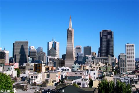 San Francisco sky-line
|
Pagine 1
|
  
West U.S.A. : like inside a movie
Località: San Francisco, Yosemite Valley, El Capitan, Sierra Nevada, Sequoia Park, Grant Grove, Kings Canyon, Bakersfield, Red Rock Canyon, Death Valley, Las Vegas, Zion Park, Cedar Breaks, Bryce Canyon, PageStato: UNITED STATES (US) By Luca, Sabrina and Federico
We finally, today is the great day of departure, with a capital P. How long we have thought about this trip ... personally, since when, still a child, I was given a book, which still jealously conservo, whose title is "Natural Wonders of the World." I remember that I was appalled and sfogliai faced with images of the Grand Canyon and many other places in that area of the United States ... but seemed so far away, almost unattainable, today we go to their achievement and a dream will become reality. Does not appear to be true, but really cross the Atlantic Ocean and all the States to land in the great "West" American. The sound of the alarm breaks into the middle of the night: they are not yet three, and, apart from Frederick, we have retained very few hours of sleep, but fatigue is not a problem because the enthusiasm, the stars, it fills the veins of adrenaline. At 3:25 comes to take his grandfather to accompany us to the airport at 3:40 and we're already in the street. The journey is short and it is incredible because, due to the work of Marconi Bologna, take off, to go to America, from our own city. Even before the 4:00 we are in front of the port of departure Ridolfi Forlì: download our stuff, salute your grandfather and we meet ... to soon! In fact, running home to take Grandma and luggage because, after so many trips in which we have accompanied for the first leg, this time to be with us. After less than an hour, finally all together, embark bags (directly to San Francisco ... speriamo bene!) And we put ourselves waiting at the door number 5 where saliremo flight KL 1582. The excitement rises as time goes on, until, in slight delay, at 6:27, the Fokker 100 of the Dutch airline KLM does not detach from the ground with destination Amsterdam. 'It is strange to see flow, beyond the window, landscapes so familiar, but it all ends in a hurry: a large cloudy interposes itself between us and prevents the earth to see all or almost, if not for some stretches, the Alps still snowy. Sabrina sleep, recovering a little 'lost sleep, while the clouds do not give us respite. We offer breakfast and, shortly later, landed at 8:14 at Schiphol International Airport in the Dutch capital, and has just rained. Landings and, after a brief sortie to the baggage claim to see that our luggage has not been discharged by mistake, we are approaching Terminal F, with the little that is fun to walk the stairs and many mobile platforms. We expect long queues before the passport control, then the metal detector at the end, however, go up on the giant Boeing 747 KLM which identified as flight KL 605, leaving the track at 12:14 p.m. Amsterdam. We are seated in the central file and unfortunately we can not see what will flow along the route under our feet. Reached the altitude and cruising speed synchronizes the clock on the time zone of San Francisco, where we arrive, and move the clock back nine hours! ... The curious thing is that the flight will last approximately ten hours and for as long chase the sun with the result of land, practically, only one hour after departure. The route goes far to the north, so now half-way through, flying over the coast of Greenland, dotted with icebergs. Later, under us, runs much of the North American continent, and Federico, eccitatissimo, absolutely fails to do what would be a providential sleep, then ends and the earth seems an immense expanse of water on our right ... is the Pacific Ocean, the only one still missing there. Following the coastline we go further south and begin to decline in share, while it appears the silhouette of a large deck ... unmistakable that the Golden Gate! Shortly after, at 13:25 local touch happily land at San Francisco International ... Here America! There seems true: we are truly legendary in California, legendary, yes, but only one of fifty states that make up the Federal Republic of the United States ... that like it or not the number one nation in the world! The plane go down and face a long queue at passport control, sound and then withdraw unless the suitcases and, after a little searching to find any food, finally get out in the open air. With the help of a monorail train arriving at the car rental area, where we turn to the bench of the Alamo company, which already had a reservation, and in a very short time we deliver, with no changes in price, a car-class than than expected: a magnificent Chevrolet Astro (targato 5HCE185 California), with lots of space and eight comfortable seats. C'immettiamo loaded the bags on Highway 101 towards the center, as well as I used to lack of exchange and the clutch pedal, we are in front of the Best Western Americana, which will host us for the next two nights. Leave room in your luggage and all, despite the fatigue really begins to be felt, we start to discover our first American metropolis. Walk down Market Street, flanked by skyscrapers drugs, we reach the bay of San Francisco and follow the seafront to the left, turn along the way up the small hill to Telegraph Hill. In the meantime the little and fell asleep to awaken bursts, perhaps rightly, a small tragedy ... does not, however, could deny the opportunity to observe the magnificent view on the skyline of Downtown (city center), with unmistakable silhouette of the Transamerica Pyramid. We take some photos then go back into the sea to visit the famous Pier 39: nice trap for tourists, situated directly opposite the island of Alcatraz, with its famous former prison. The pier is known mainly because of its quays has established a large colony of sea lions, but at this time of year usually migrates to the south, in fact there are only some examples, of course, immortality, but it has proved a small disappointment. We stop to have dinner in a restaurant on the Pier, with the view that stretches beyond the window in the distance, until the Golden Gate, then, shortly after 9:00, destroyed by the effects of travel and time zone, go back to the hotel and we collect in a room having a deserved rest.
Even before the 8:00 we are all in the street, ready to launch the first real day as tourists in the States ... and what better way to start if not with a hearty American breakfast? Refresh properly climb on a minibus, available for free from, and arrive at Union Square, the square, which is rather 'the heart of San Francisco, surrounded by numerous skyscrapers. One block away is the station of the Cable Cars, the only means of transportation in the world considered historical monument! The cars, without which San Francisco would lose part of its charm, rattle up and down the hills of the city, dealing with success also slopes exceeding 20%! To go with a snap Rampino to a steel cable that runs without end between the rails, while leaving to go to free-wheel in the giddy descent, using only the handbrake to slow down. Finally came to an end are rotated by hand to one hundred degrees by means of a large rotating platform, the transaction taking place awaiting to buy tickets that will allow us to travel on the Cable Cars for the entire day. Climb on board but we only a short stretch of line, up to Union Square, where we descend. Back in the car later, after visiting a foot a part of the city not served by such means. In short, we face the Chinatown Gate, the symbolic door that gives access to what may be considered, with its one hundred thousand residents, after New York, the most populous Chinese community outside Asia. The ancestors of current residents settled in the area already in 1848 and since then began to build a city within a city, with oriental features clearly, those same features that characterize it today. We Grant Avenue, real backbone of the neighborhood, with its typical white-red lamps and the construction of a pagoda roof, but also look at what was the first cathedral of San Francisco, St. Mary's Church (unfortunately for you, today, completely out of place). We visit the nearby Waverly Place colorful, rich oriental decorations, then momentarily leave Chinatown. We enter the nearby Downtown, a completely different reality, with its dizzying skyscrapers, among which stands out in size and shape to the Transamerica Pyramid. The building, which characterizes most degl'altri the skyline of the city can offer, if seen from its base, a particularly evocative. After the skyscrapers face the climb that takes us back on the hill to Chinatown, passing in front of the imaginative building of the Bank of Canton, and regained the line of the Cable Cars. Go up on that first pass and soon enough we are at the end of Fisherman's Wharf ... precisely that to which we did not want to get there. Does not matter, because travel on these strange cars is also fun, so, without father, go back to climb the hills of San Francisco. Want to change lines descend in front of the small museum dedicated to these incredible vehicles is located inside a building carefully restored and one can observe the machinery that allows the operation of the Cable Cars in the city. After the short but interesting visit to finally go up on the car and go right to the conquest of the incredible slopes of Powell-Hide Line: The stretch of rail far more evocative and exciting. Thus we come to the right terminus, in Hide Street, opposite the wharf where the Historic Ship: an interesting parade of old boats, ideally headed by the Balclutha, a large sailing ship with three masts in addition to which, in the distance, it out disturbing the shape of the island of Alcatraz. After a fast toccata and fugue at the nearby Ghirardelli Square (chocolate kingdom), we visit, to the delight of the small, the Historic Ship, where, in addition to the boat, you can see the Hercules, an old tugboat, and the Eureka (with propulsion blades), once the largest ferry in the world. Explored, for want of Frederick, any smaller boat anfratto c'incamminiamo then along the road that runs alongside the sea, to reach Fisherman's Wharf. The old quarter of the fishermen and the food factory has been transformed over time into a perfect trap for tourists, in which, given time, whether we are ensnared. Lunch and return at the end of the Cable Cars, we reverse the picturesque hills, and soon enough we are in Union Square, where a parade pace incessant an incredible number of Limousine. Thanks to the Best Western bus to return and, this time with the car, leaving for the second part of the day. Cross the entire city from east to west, and arrive on the shores of the Pacific Ocean, in view of the famous Golden Gate. The most famous suspension bridges was opened in 1937, after being designed and built in just five years. Currently, each week, a team of twenty-five painters use about two tons of aluminum to make the structure impeccable, and it is the color of the aluminum to characterize the Golden Gate that stands out reddish admirably against the backdrop of the Bay of San Francisco. Cross quest'incredibile engineering work and we stop at Vista Point, a vantage point right on the edge of the bridge, which allows us to observe the construction in the right angle, plus the skyscrapers of Downtown that stand out on the blue sky in the distance. We take many photos and then do a walk up to the pylon, while a wind blowing from the cold and the bridge, albeit imperceptibly, oscillates in a little reassuring. Regained as the comfortable seats of the car and descend on the shores of the bay, the town of Sausalito ... which is nice, but nothing exceptional. Heading in the direction of Golden Gate and take the road that s'inoltra in the Golden Gate Recreation Area, a protected area on the shores of the Pacific: from there you can admire the bridge, from the cliffs, in all its majesty! Observed the Golden Gate, from almost all angles possible, take the road through the center of San Francisco and passing along the stretch of Lombard Street known as "The crookedest street" (a tortuous road), one of the most famous and perhaps precisely even the most tortuous of the world, made famous thanks to the many films that have been set ... these are really incredible Americans! Thus, we arrive now at the end of the day, near the Pier 39: the intention would be to take an ice cream for dinner, but we do not find parking, so we decide to go first to see the sunset from Treasure Island. The choice is revealed to be a small mistake, it is to confirm our doubts about that place, situated in the middle of the bay, you can reach along the picturesque Oakland Bay Bridge (two floors, the lower to the upper exit and to enter a San Francisco), the sun drops away from the city skyline and the sunset is nothing exceptional in most Federico rightly tired, gave the crash, including the effect of time zone, and forces us to return to the hotel without having dinner . The day ends well, between the tears of small, so quite daring, but this does not detract from the extraordinary things that we have vis
Due to the effects of time zone is not a problem getting up early in the morning and shortly after 7:00 we were ready to go. Eat a good breakfast and we are in the car on the streets of San Francisco that, in view of the public holiday, are semi-deserted. It travels incredibly shipped, so in a very short time we come to Alamo Square. On this kind of square sets the group's most famous houses in the city, the so-called Painted Ladies: six houses in Victorian style, which contrasts beautifully against the backdrop of the skyscrapers of Downtown ... but they are in shade and come back later to photograph them. To tell the truth, the whole area is dotted with buildings built in this style: lovely buildings that seem to leave a book of fairy tales. We can not do without notarle, along with a characteristic half fire, along the road from Alamo Square brings us to the Mission district, historically the first in the city. From this place it was originally the name San Francisco, and more precisely from the group of Spanish Franciscans in 1776 founded the Mission Dolores, the same church that we see today. The chapel, in particular, built in 1782, is the oldest building in town. We take some pictures and then drive, we reach the Golden Gate Park, big green located in the center-west of the city. In particular, we go to the Japanese Tea Garden, a small and well-kept Japanese garden in which we spend a little 'time walking quietly among bridges, pagodas and bonsai, immersed in an extraordinary stillness, so that does not seem to be in center of a large metropolis. Just as in the nearby botanical gardens, a little 'less cared for, but literally invaded by squirrels that run around looking for food. We finish the visit to Golden Gate Park to the Conservatory of Flowers, a beautiful greenhouse built in 1878, Victorian style, in which, in a humidity almost unbearable, we see many beautiful species of flowers and tropical plants. The first part of the day has flown away and was made late, because we expect the check-out at Best Western until 12:00, so we return to the hotel, we retrieve our luggage and board with a start. Before leaving San Francisco we have an outstanding account to be settled with the Painted Ladies, and then we head back to Alamo Square. Compared to the morning but something has changed. The city has awakened, and in particular, was launched at an event well known in these parts: the Californian metropolis is one of the world capitals of homosexuality and in Market Street now be staged on Gay Pride. We heterosexuals are not affected but the traffic is almost completely blocked in the area, and photos including the Painted Ladies, spend over an hour to leave the city and to take the Oakland Bay Bridge. We thus leave behind San Francisco, with its architectural wonders and landscapes that make it unique ... Perhaps, as many say, is truly the most beautiful cities in the States. We cross the bay and we virtually started the tour on the road in the south-west America in front of us the way to reach the ideal goal is long but very interesting. We few tens of miles further inland, and when we stop in a parking lot along the highway to eat a snack, we can not help but notice that the outside temperature has already changed and splashed upwards ... it makes a hell hot! We the central plains to California, all grown, sometimes vaguely reminds us of the Po Valley and in the late afternoon we reach the small town of Mariposa, located about fifty miles from the Yosemite National Park, which will visit tomorrow. We stop for the night in a hotel chain Super 8. Go up in the room and later descend to dine in a Mexican restaurant, then, tired, we thought about our bed, for tomorrow's scheduled another tough but, hopefully, beautiful day.
We do not want to lose a good habit to wake up early, making the most of the course of the day, and so do. Having enjoyed the breakfast, included in the price of the room, shoot some photos for some typical buildings of Mariposa and depart with the intention of visiting our first great national park: the Yosemite (pronounced Iossemiti). We follow the road number 140 that s'inoltra in the Sierra Nevada and soon we find the valley where flows the Merced River, the river that comes from the Yosemite Valley, while the landscape around us is becoming increasingly harsh. Thus, we arrive in about an hour at the entrance to the park, where for $ 65, buy the Golden Eagle Pass, a card that will give us the opportunity to join all the other national parks of the U.S.. Cross as a little 'excited the gate which gives access to what was the first natural park in the world, established by a decree signed by Abraham Lincoln himself, in 1864. The Yosemite, so named in homage to the Indian tribes of uzum, exterminated in the mid-nineteenth century, stretches for thousands of hectares, incorporating into its boundaries grandiose mountains that reach 4000 meters in height ... But we are satisfied to visit only a small part. After a narrow opening before our eyes the Yosemite Valley and immediately to our left, the impressive silhouette of El Capitan, one of the highest cliffs known, with its almost 900 meters vertically, meeting point of free climbers from around the world. A little later on the same side of the valley, we see the Yosemite Falls, spectacular waterfalls in three jumps exceed a height difference of 739 meters, making it the highest in the North America and among the first on the planet. The spectacle of nature literally conquered us, while we continue to submit in this strange valley whose bottom, a few kilometers wide, is completely flat and in stark contrast to the impressive granite peaks surrounding, among which stands out the Half Dome, magnificent monolith by characteristic form, which has become a 'symbol of Yosemite. A road, one way, makes the tour of the valley, going up on the left side and then come out the other side. In its central part along the Merded River, which flows placid forming large loops in a wonderful natural scenery. Scenario we are trying to enjoy with a stop along the banks of the river, accompanied by a short walk, in peace. Later, along the ribbon of asphalt, we also stop at the point from which, through a modest traipsing down, in a beautiful environment, we reach the base of Yosemite Falls. We would like to remain longer in these places, but time flies and they are almost 11:00 am when we leave the valley to begin to rise along the road to Glacier Point. Spend about an hour to reach the 2200 meters of altitude of the viewpoint perhaps the most famous park, located at the top of a hill overlooking the Yosemite Valley, but after an interminable series of twists come abundantly rewarded. The show from up here is nothing short of breathtaking: the valley is now under our feet and the view at the center the imposing silhouette dell'Half Dome, right on the Vernal and Nevada Falls, which is particularly rich in water, and left on Yosemite Falls, which, though so great, from quest'altezza seem almost like un'insignificante rigagnolo. The vastness of the scenery is such as to leave us amazed and in contemplation for some time ... Then, slowly, we return on our steps toward the car for lunch and fill out so something else besides agl'occhi already saturated with wonders. Done full of energy we move a few miles, we leave the car in a parking lot at the edge of the road and along the c'incamminiamo Taft Trail. Follow the path across a beautiful stretch of forest, with huge plants, and less than half an hour we arrive at its end, which looks as Glacier Point, on the Yosemite Valley. We pass next to the so-called fissures, dizzying cuts into the rock, as fendenti a large knife, inflicted by those who knows the harsh edge of the precipice, and we come in sight of the extraordinary granite outcrop of Taft. It 'a kind of natural balcony magisterially suspended several hundred meters from the valley floor and the spectacle, with the view that goes on in front of El Capitan, is great ... So we stay for a while 'to observe the landscape, and several squirrels, to the delight of Frederick, we skip around, then, fully satisfied with the result that more positive results of this first trail, we look at the way back. By car starting Yosemite leaving us behind, but taking with us memories gl'indelebili of its natural wonders. We expect a beautiful stretch of road before leaving the stage and, in practice, we descend from the Sierra Nevada and then, in part, be traced back. Thus we come almost to 20:00, at the Best Western Holiday Lodge Three Rivers, now at the edge of Sequoia National Park, which will visit tomorrow. We wash a little and go out for dinner at a Pizza Factory, ending the day with a good laugh thanks to his grandfather who, not yet in tune with the American fast-food, when, in full good faith, throws everything in the waste bin ... Tray included! ... And with a smile on his lips still printed there we go into a rest room.
We became fast: at 7:15 we are out of the room, and eaten breakfast at 8:00 in the street already. We follow the asphalt ribbon of Highway number 198, a curve after another, s'arrampica the Sierra Nevada and soon we enter the Sequoia National Park. The park, established in 1890 mainly to protect the thousand trees from which it takes its name, grows at an average in excess of 2000 meters, so even after the entrance, we climb into an interminable series of curves, while around us the landscape does not present signs of forests it, let alone to redwood, and if we had not been on very specific information we would probably doubt arose that he had the wrong street ... Instead, at one of the last curve, we see the silhouette of three large trees in single file and from that point forward, with them, is also the whole, lush, forest. We continue to go up a little ', reaching close to a visitor center, across from the towers as The Sentinel, a huge redwood. From there, turn a back road in the direction of Crescent Meadow, and hovers in the air a little 'smoke due to a small fire nearby: ask for security information to a ranger ... nothing to worry about, I answered. Large plants stand out among the others, as well as for size, even for their bark clearer: they are truly a marvel, so we stop to them before and is able to tap indescribable emotion. Following the road we come to the so-called Tunnel Log, a tunnel dug through the trunk of a large sequoia fall time ago for some reason. Complete, finally, the visit of this area of the park leaving the car in a parking lot to go to Moro Rock, a rocky outcrop on which it is a short but adventure fraught trail. The trail is, at times, dizzying and about half-way through Sabrina, who has good relations with the empty, scared stops to expect, because we, "fearless", continue to the top, from where you have a good d ' eye on the hills surrounding ... sin only for the smoke and haze. Leaving Crescent Meadow, on return from walk, raise further our contact with nature sights in a short period of time, two deer (probably deer) ... while the squirrels, many have long ceased to count them. Back to travel the main road and we come in the middle of the park, in a large parking area where we let the car go in front of "his majesty" General Sherman ... E 'un'incommensurabile honor the deal the largest living thing on the planet with its 83 meters in height is not the highest existing redwood and even the biggest, although the 11 meters in diameter at the base, but is fact that the Mass General appears to be unbeatable, despite the age, between 2300 and 2700 years, it is in great shape and health bursting from all the branches. After photos of Rite c'incamminiamo along the Congress Trail, an easy trail that winds within the Giant Forest. E 'along this path that we can see many examples of giant sequoia, sometimes unfortunately damaged, more or less seriously, by the numerous fires, which seem to flourish here, almost exclusively, of natural causes. Size and state of conservation stands out in particular the tree nicknamed The President, with the assistance of a few tens of meters from a large group of sequoias that, given the excellent close, nothing could be that the so-called Senate! After an hour of complete immersion abundant in nature, including the sighting of a beautiful deer, we are back ... tired but also very satisfied of this traipsing down. Heading in the car and walk in a discrete section of the road: we leave behind the Sequoia National Park and enter in Kings Canyon National Park. The two parks are very similar and almost a continuation of the other, so that one wonders why not a single ... unfortunately ignore him, but one reason certainly will. Now we get to Grant Grove, the grove of Grant are already 13:00 and lunch, as always "the bag" before making a short walking tour of the forest, of course, dominated by General Grant, a little 'younger and less high end of its most famous parigrado Sherman, but with a greater diameter at base, which exceeds 12 meters. Just then, linking the entire military hierarchy to the context, we can not help but notice an incredible number of "officers" ... often high and deserving of honors. To complete the picture, I could not, of course, on the field ... an "old mate", heavily to the ground in 1969, which has remained virtually the only bark ... you can safely walk inside and it is a strange feeling that enjoys particularly the small. Grant Grove is truly a fantastic place and, ultimately, the sequoias of Kings Canyon are perhaps more beautiful than those of its most famous park borders. In the early afternoon, reluctantly, we leave these exceptional monuments of nature before it can consider the closed stage we still the beauty of 450 kilometers. Descend from the Sierra along a secondary road winding so as to almost girar la testa, then finally arrived in the vast central plains California: a single, huge garden in which grow all over. Arrived near the town of Bakersfield, however deviamo east and in a few miles the landscape changes radically: the desert, dotted with Joshua Tree, takes the upper hand and warm colors become dominant. We pass through the small Red Rock Canyon State Park, and shortly after, in the distance, see the houses of Ridgecrest, in whose outskirts, in a hotel chain Econo Lodge, we stop for the night. We go out for dinner from Denny's, a type of fast-food over which I had excellent references (confirmed in full), then we return to the hotel and, mentally rehearsing the emotions that we have given the giants of the forest, slowly slipped into the world of dreams.
First Part
Very soon that will, undoubtedly, the longest day of the trip, in fact, after the usual visits and more than 500 kilometers of road traveled, we dedicate this evening to the madness of Las Vegas. Even before the 8:00 we travel along the Highway number 178 in the direction of Death Valley. Beyond the sliding windows and inhospitable desert landscapes, so that, through the town of Trona disconcerting, we are to ask how we can decide to live in certain places, especially when nearby there are a lot better. The landscape, for non-residents like us, it is fascinating, even though this morning, unfortunately, we are not accompanied by the sun ... nothing serious, it should not rain, but if someone at the start of this journey, I had said that today, while we are heading into one of the warmest places on the planet, the sky was cloudy, well, there certainly would have believed! About mid-morning, after a long descent, we enter into the legendary Death Valley (from 1933 included in the Death Valley National Monument). It 'one of the deepest depressions in the northern hemisphere, with its lowest point at 85.5 meters below sea level, and, given its hellish climate (in 1913 it reached the most 57 degrees Celsius), owes left his name to the sentence pronounced by a pioneer who, escaped a danger nell'attraversarla, more or less, it seems, so he said: "Thank God we have emerged from this valley of death." We, without concern, and instead will enter Stovepipe Wells, tiny collection of buildings with some commercial premises, we make the first stop, while the heat is beginning to be felt and, in the distance, a few flashes of clear sky leaves us hope. We continue to follow the road to the valley floor and descend below sea level with a view that sweeps to the left on Sand Dunes: a piece of the Sahara in the American West, but the way to visit is closed to traffic and private cars are in the distance, like the sun behind the clouds ... We reported to the heart of this place, metro after metro, we see more and more surreal, like the dirt that short detour brings us to the Mustard Canyon ... The name is appropriate because the strange heaps of arid land that line the route in its own recall the well-known condiment. Nearby we visit the ruins of an old mine borax. There was a time when the valley became the protagonist of a small economic boom, with the extraction of this mineral, but then ended, supplanted, several decades later by another resource, yet skillfully exploited: tourism. Past Furnace Creek, the oasis that in practice, is the capital of Death Valley, and the only place where you can also stay, and turn right on the road continues to descend towards Badwater Basin, the lowest point of this incredible depression ... When you finally arrive, surrounded by blinding white salt covering the bottom of an ancient river basin, in that extraordinary place, 282 feet (85.5 meters) below sea level including the sun, thanks to God, wins his battle and quit overbearingly uncovered delights of his presence. Spent some 'time and took the photo in front of the sign written on the share, which will, undoubtedly, the lowest point of the trip, we return to calm in the direction of Furnace Creek, in fact, along the route, we expect different stages. The first is the Devil's Golf Course (literally the "Golf Course of the devil"). It 'a strange phenomenon brought on stage from the ground and salt crystals, with the complicity of the weather: it seems to be in the middle of a plowed field, where a plow, probably, is never past. A little further on turn right on the so-called Drive Artist: a road, one way, the adventure that is the basis of an amphitheater in the rock, pigmented by numerous minerals, took imaginative tone. It 'a show and a different view at every turn, until the triumphant explosion of colors dell'Artist Palette "the palette" on which a fictional singer seems to have mixed ocher, yellow, white and blue in search of their infinite nuances. Almost 14:00 when regaining the main road. Attardi us a little 'to photograph the strange Mushroom Rock (a fungus that the grandparents, even inveterate seekers, can not grasp), then finally lunch, in the shadow of a rare tree in a parking lot of Furnace Creek. Half an hour break, not more, and again we throw ourselves headlong into the tour of Death Valley. Turn this time, Route 190, coming out towards the east, and we will stop almost immediately at Zabriskie Point, a place made famous from the film Antognoni. The geological phenomenon that can be seen from this vantage point is one of the most fascinating of the valley, with ravines eroded by the weather that seem pesta of paper and yellow stands out beautifully on the deep blue of the sky behind it. A little over Zabriskie Point you can take another detour (one way), which detaches from the main track and not to let slip. We are so in Twenty Mule Canyon, along the track that followed the convoys loaded with borax, generally driven precisely by twenty (twenty) mules ... in that time, perhaps, no one had the time and the desire to look like us, that the surrounding landscape, beautiful in its raw desolation, certainly deserves rather more than a look. Ideally we take away the mask and snorkel and emerge ... from sea level, then take to rise, without a moment's pause, even at bends, to reach almost 1,700 meters of Dante's View, a kind of balcony on the Death Valley Natural ... The gigantic depression is now under our feet and embraces all in a single glance, with the white expanse of salt of the Badwater Basin, which looks like a frozen lake and right in front of the Telescope Peak, which sum if its height (3368 meters) to the bottom of negative gradient of the huge reach 3453 meters! ... does not seem to see them, but that is the case! With the adrenaline a thousand salute the Death Valley that, thanks to the emotions that we have a gift, despite the name, makes us feel more alive than ever. We still a few tens of miles and also salute California (which will meet again at the end of travel) to enter the state of Nevada. The ribbon of smooth asphalt slides away under the wheels of our Chevrolet, and the sun inexorably down towards the line of enhancing the colors dell'arido landscape that runs faster on the sides of the car, over the windows, then all 'Suddenly, after a rise, it seems unlikely the gauge of a city ... seems a mirage, but it just Las Vegas!
Second Part
Landing in a metropolis of entertainment for excellence shortly after 19:00 and now we go to where accommodation: the fantastic Luxor, the Egyptian theme of course, with a sphinx-size on the front and one of the largest in the world, with its 4400 rooms. For the first twenty posts this special ranking there are eighteen well in Las Vegas, which has monopolized the podium hypothetical: at the first place the The Venetian, with about 7000 suites, at the Mgm second, with 5005 rooms and the third its the Luxor! We enter the hall (very impressive), and removed the keys, we reach one of the first floors (tenth!) With the lift, which here is called "inclinator", given that up along the inside edges of the great pyramid that characterizes the complex . Let's take a quick shower and then go out on the Strip, the main street of Las Vegas that, with the arrival of darkness, has been transformed and now is a great sparkling lights. It 'strange history of Las Vegas (and Nevada): Less than a century ago it was only a place of passage, so local laws, unlike other states, provided the times are far shorter, especially for practices divorce (42 days) ... but it was also easier to get married. Unintentionally what attracted people ... and the need to maintain (with gambling) then caused the spark, thanks to which today we can see all this. It seems madness: the largest hotel-casino in Las Vegas are situated along the Strip, whose name is appropriate, because it means stripping off completely to the game and someone you can lose more ... even clothes. With a monorail train arrive near the Excalibur hotel that focuses on the theme of King Arthur, has the form of a beautiful medieval castle. Next is the amazing New York-New York, which reconstructs faithfully, though in a smaller scale, the most famous skyscrapers in Manhattan (not the Twin Towers, fortunately), and in front of the gigantic towers Mgm. Dinner along the Strip in a fast-food restaurants and take our walk nell'impareggiabile American extravagance. Wander among the tables of the green-Paris Las Vegas, featuring playback (150 meters high!) Of the Eiffel Tower and admire just opposite the Hotel Bellagio, with its magnificent fountains dancing. Next to it is then the great Caesar's Palace, built on Roman history and background of the boxing matches. The strenuous dancing fountains of Bellagio to other hotels offer free show, pretending like the spectacular volcanic eruption of the Mirage ... but the show the most incredible offers on Treasure Island: a cast of actors and stunt-man puts in an astonishing scene pirate ship battle, in a dance. The performances are held every hour and a half and we, unfortunately, we arrived just minutes before the final, so we can not take a good position to see and do not enjoy the ... sin! On the other side of the road, compared to Treasure Island, we see the incredible The Venetian, with faithfully reconstructed the Grand Canal and some famous views of Venice, while the clock, completing the last round, the trigger date and in an instant is ...
The fatigue is beginning to be felt but, undeterred, continue to visit in Las Vegas by bus and arrive to see Downtown Fremont Street, the historic heart of the city, with its extraordinary turn of lights, given the late hours now, is only functional part ... little better than nothing, however, says a popular theory. And 'now the 1: 00 and our strength has been sorely tested (Frederick, eight years later this month, there was really amazed!), So exhausted Heading in the bus which takes us back frozen (for air conditioning kept inexplicably high) fin in front of our hotel. Drag us into the room and happy for the success of an unforgettable day, we give a few hours of rest. When the alarm sounds we seem to have closed his eyes for a few minutes and it is not easy to reopen, but the enthusiasm and helps us in short we are ready, with luggage in hand, to descend from the great pyramid. We drive the Strip, which with the light of day is another effect, we stop to have breakfast from Denny's and even mid-morning we are ready for a new adventure. We leave Las Vegas to the north-east on Interstate 15 and the number after a few tens of miles turn right following the signs to the Valley of Fire State Park, established in 1935, is the oldest park state of Nevada. Along the short stretch of road that leads us to the landscape begins to show the special characteristics of the area, with the typical rock formations of reddish color, which probably inspired the name (Valley of Fire). At the entrance there is no ranger and leave, as all fans (with a great sense of civilization), the five U.S. dollars required inside an envelope in a separate container, as state parks in the Golden Eagle Pass is not valid, and we start the visit. Immediately we encounter the curious conformations such beehives, thus making a short detour, a small natural arch, where Federico da climbing immediately, and the Ati Ati Rock, a rocky outcrop, which emerge from the sand as the red fire, which is incised petroglyphs found some old Indian of more than four years. Following a road on the left we move towards the heart of the park, and a spiteful Nuvolone is placed right on our heads and the beautiful vantage point that, for the infinite nuances of color, Rainbow Vista is diminished to the point that, out of anger, I avoid even a photo. Proceed so far sent the tape ends of asphalt at the foot of White Dome, and, anticipating the times, we stop for lunch until the sun returns. Our choice is rewarded, and on time, the clouds go away again, leaving room for the clear sky, so we go to see the nearby Canyon Fire (the name is a guarantee) and the return, stop in replicating the Rainbow Vista, we can finally take a long desired photos left out in the morning. Avoided for the hellish hot walk in the canyon that Mouse's Tank, we begin to leave the park to the east and, along the road met the special Seven Sisters (seven scenic rocks in single file), we stop to see the Elephant Rock, which is un po 'conformation rocky symbol Valley of Fire. To do this we must take a short trail to an eighth of a mile (as well also includes a sign on the side of the car park), but is a cancellation so consumed several times the distance on the hot soil of Nevada, we can not quite find the rock (strangely ill-marked). So I do not give peace to this small but we have failed to go strength, because we are tired, and accaldati you're doing later. We leave behind the Valley of Fire State Park, which, after all, we have met and earning the right attention, and regain the intestate according to the number 15 which, towards the north-east, also salute the state of Nevada to enter into Arizona. Changing the time zone and we put the clock forward an hour, and proceed to the bottom dell'accattivante Virgin River Canyon, which leads us to cross the borders of Utah. A great strides we approach the scenic peaks of Zion National Park and arrive in the town of Springdale, where we take accommodation in local hotels in the Quality Inn chain. We leave the suitcases in the room and, after a quick shower, start by car. Cross the entrance of Zion National Park and just along the deviamo Mount Caramel Highway, beautiful scenic route flanked by mountains that wear incredible colors, among which stands out the Checkerboard Mesa. The measurements suddenly disappear when we leave the park, and we are traveling on a vast green plateau. Proceed in this scenario, shipped again for several miles, doing practice runs with the sun is setting, and arrive in time to observe the wonderful red sand dunes of the Coral Pink Sand Dunes State Park with the warm light of dusk. We are walking on the soft sand, studded with beautiful yellow flowers, until the last ray of sun light, emphasizing the ardent tone, then, still in awe, we return to follow the path in reverse order to return all 'hotel. We stop to have dinner in a restaurant along the route and arrive at the Quality Inn with a wonderful dark and starry, thereby closing the best possible way, this beautiful and eventful day.
Exactly one week from start of this wonderful journey we get up from bed delighted by the view that spans the heights of Zion National Park. Sparkling in the morning there is a tremendous pace and we can prepare with relative calm at the Quality Inn because they do not serve breakfast before 8:00. Point we present, among others, the opening of the space: in this way even before the 9:00 we are ready to dedicate to the visit of our national park daily. Zion is yes, since 1919, the name of a park that previously was for a long time place of refuge pioneer Mormons, but it is the name of a canyon formed by the Virgin River over millions of years and the trail for nearly ten miles , also in a spectacular way. Cross (for the second time) the entrance of Zion National Park and, on the right leaving the crossing for the Mount Caramel Highway, we enter into Zion Canyon. The cliffs around us fantastic display colors ranging from beige to pink, from orange to red, and the way we are ever more bitter. About half of the trail asphalted road, near the Zion Lodge, we should not stop us from that point forward, in fact, in high season, is not transit to private vehicles and must continue with the aid of a shuttle (completely free) . Park your car and, before you submit further in the canyon, we dedicate ourselves to a brief walk that kicks off just in front of the Zion Lodge. A paved trail leads, in less than half an hour, the so-called Emerald Pools, a delightful place, where you can easily walk to some waterfalls below: thin threads of water coming down, scenographically, from a ledge of rock above. One could continue with the path fin higher, but this does not seem to offer anything more landscape, so we decide to go back: there are still many things to do in this day and we intend to use the time available to us in the best possible way. Climb and descend on the bus two stops later to do, this time, the walk to Weeping Rock. The trail, short but fraught, leads to below a rock wall from which water falls with a pleasing effect to drizzle. We observe the phenomenon, without running the risk of wet, one indentation in the side of the mountain: a kind of natural balcony situated in a privileged position, just behind the cascade, from which we can also enjoy the splendid view of the red peaks of Zion. Decreased from Weeping Rock Heading in on the bus, which takes us far ends of the tape and asphalt from the Riverside Walk. Long walk on this path, next to the Virgin River, with the canyon walls that gradually approaching more and more, and we come to the so-called Narrows (bottlenecks), where only the river has the privilege of having a gate between the mountains. In this part, in fact, long hike, which takes place almost entirely into the river whose waters are, to say the least, cold. We will be content to take some photos and a brief stop ... Frederick, however, is fun to build dams using the stones of the stream, while many squirrels around scorazzano nicely in search of that food that tourists, according to strict rules of the park, just can not give. Negl'occhi still with the extraordinary landscapes of Zion Canyon go back to self: the time has flown and it is already past noon for almost an hour, well, consumed deserved lunch, we resume without further delay our trip. Leave the park to the south, from Springdale, to come back again a little more to the north following the short detour that leads us all'accattivante viewpoint of Kolob Canyon. We take some photos and then finally leave the red peaks of Zion, which certainly did not disappointed our expectations. We Highway Number 15 to the town of Cedar, and from there we start to climb the mountains. C'inoltriamo in the green landscape of the Dixie National Forest, and a curve after another, we reach and exceed the ten thousand feet (about three thousand meters) of altitude, landing on a vast plateau. The landscape is slightly undulating, almost flat, and nothing would indicate what we expect, however. First, a cartel, then a parking lot next to the office of ranger make us realize that we have arrived in Cedar Breaks National Monument, a protected area established in 1933 by President Franklin D. Roosevelt. We leave the car there and overlook the scenic Point Supreme with An exclamation of surprise that leaves us breathless: the plateau suddenly sinks in an amphitheater eroded by the weather, among the thousand nuances of the land, stained by iron oxides and manganese in contrast with the green of the forest, which is the greater, and the deep blue of the sky. On foot follow a short trail that runs along the edge of the precipice, and we are coming, including magnificent views, to Spectra Point, where a few thousand years and grow contorti arista pines, among the longest plant species on the planet, while here and there, Despite the summer already made, there are still small patches of snow. Enraptured by the sight of so much beauty we, without haste, but the path back to the parking lot, we lost more time than expected, but it is absolutely worth the pain. The ribbon of asphalt for a few miles below, a short distance, the edge of Cedar Breaks, offering different viewpoints that do not let us escape, then, take a road on right away, we have behind this extraordinary place. Cross green landscapes (it is amazing, only yesterday we were in the desert!) And down slightly to arrive at the entrance to the share Ut12 Scenic Byway, according to many the most beautiful streets of the U.S.. But today, we shall only short, what passes for the Red Canyon, with the light of the sun, now close to sunset, which enhances the warm tones ... another wonder of this beautiful day. In this way we arrive at Rubys Inn, tiny village situated at the entrance of Bryce Canyon National Park, and there we nell'omonima accommodation Best Western. Also this evening became late and dinner in a pizzeria more than 21:00, so just in practice, is also the time to lie down ... We have come long way on foot among some of the wonders of Utah and we are all tired but happy, so very soon we find ourselves in the world of dreams, even if, until now, all the voyage seems to be a single, big dream.
Shortly after 8:00 we are ready to dedicate ourselves to a visit to one of the most famous American parks: the Bryce Canyon National Park, created in 1924 in order to preserve, despite the name, what in reality is not a canyon, but a limestone plateau eroded by the forces of nature. What the Indians called "red rocks standing like so many men ..." conformations are the features of the place: multicolored pinnacles that defy the laws of gravity, called "Hoodoo". We are more than two thousand meters of altitude and the air of early morning is quite cool, so covered more than usual are going to travel the short stretch of road that separates the hotel from the park and in short we are all ' inside of Bryce Canyon, so named in honor of Ebeneezer Bryce, a Mormon who first settled there at the end of the nineteenth century. Following the directions we arrive at the parking lot of Sunset Point and with trepidation we sull'incredibile amphitheater overlooking ... the glance is sublime and the tide of colorful pinnacles ago almost girar la testa. Walking on the edge of the cliff, with magnificent views, come to Sunrise Point and from there we start our trip in the heart of the park. Descend along the Queens Garden Trail, and protected from the breeze blowing at the top of the cliffs, the temperature changes abruptly. Lighten the estate, we protect the head from the sun and we will venture between Hoodoo. E 'extraordinary at every step changes the scenario and hence we are forced to take a picture ... accompanied dagl'immancabili squirrels, many, scorazzano all around us. Fortunately, the heat (which we were prepared) is sopportabilissimo, so we can fully enjoy the walk taking place between beautiful and scenic passages until you reach the bottom of the great chasm. Heading in the long-known Navajo Trail and in its concluding part we follow the most attractive and stunning: the path is narrow and Hoodoo s'insinua between high and some trees, which seem to defy the pinnacles in a bid to win the light of the awaited sun. This unique and bold vertical world has been called "Wall Street" ... and proximity to the dizzying skyscrapers of New York streets seems really appropriate. The last meters of the Navajo Trail, which bring us back to the summit are steep, but the beauty of the place alone overcome fatigue to deal with them ... so, after nearly five kilometers, is the smallest of the group to cut ideally the goal of Sunset Point (Grand Prix of the mountain first class!) and earning the praise of the case. Regained the car, now at noon, we start to explore the various lookout points scattered along the park. From Inspiration Point we can observe the amazing sea of peaks of Silent City Bryce Point and the entire, incredible, fantastic rocks amphitheater, masterfully sculpted by mother nature. From this point onwards the Bryce Canyon National Park stretches southwards offering glimpses of less spectacular but still beautiful as the view that one can enjoy by Farview Point, the place where we stop to have lunch. In the early afternoon, sending them further into the park, we observe the charming Natural Bridge and the great features that Hoodoo Agua Canyon, then, came where the road ends, at 2700 meters, we reach on foot and Rainbow Yovimpa Point, from which it dominates literally the entire landscape. Thanks to the clearness of the air in this area of Utah and with the help of a cartel illustration, which shows us some reference points, we realize that in fact the sight in front of us at a distance range that exceeds even the three hundred kilometers ! The great American west never ceases to amaze and astounding even for them, incredible numbers return, when the sun is still high in the sky in the direction of Rubys Inn. On the way spotted a beautiful deer that we pause to observe until, frightened by our presence, not disappear into the bush, then we arrive at the Best Western where to spend this night. Not having other travels miles to close the stage and after a week's trip to say the least intense, so we can finally give some time to relax, for the immense joy of Frederick, in this way can take a bath in the swimming pool. Before evening we go face to take a picture at the nearby Red Canyon and back to some vague 'one of the shops Rubys Inn, then, after supper, we rushed to Sunset Point to watch the sunset, but a big Nuvolone, low on the horizon, we "ruin" the party irreparably ... sin. Salute as Bryce Canyon, which will remain forever in our hearts, and we go back to for the night ... needless to say: Another memorable day came to a successful conclusion.
E 'l'Independence Day: National Day, which, unfortunately for the Americans, this year falls on a Sunday. For us on vacation, however, is a beautiful day like all those that preceded it and, hopefully, such as those that follow. But just yesterday we saw the amazing Bryce Canyon, and now it will not be easy to find something more beautiful, but will be especially difficult for small things can satisfy. Despite this, of course, do not despair and with morale sky leave confident Rubys Inn in north-east, along the Route number 12. Walk a few miles near the town of Cannonville deviamo on the right along the road that leads us to Kodachrome Basin State Park. The little state park is characterized by fantastic rocks, vaguely purple, smoothed by erosion and owes its name to the National Geographic Society who, in 1948, given the colors of the place, so named in honor of the known photographic film. We enter the protected area, where peace reigns and the absolute tranquility: it may be on the agenda hyper holiday, in complicity with the time, but we seem to just be the only tourists in the park ... and thanks to this, probably, we can see some large hares and partridge with a nice little all with you. We leave the car and along the short c'incamminiamo Angels Palace Trail, climbing the hills on the first, we make enough of the idea of geological and landscape of the place, offering, at times, even very interesting views. Regained the car then we move a short distance to face the walkway that leads us to the foot of the so-called Shakespeare Arch, which, quite small and obscure, not particularly scenic ... On balance, however, we prepare to leave the Kodachrome Basin satisfied for the time that we wanted to dedicate ... and is already a success after seeing only yesterday, the inimitable Bryce Canyon. Let us not walk the ten miles of dirt road leading to the Grosvenor Arch and back to follow the Highway number 12, which for a long time gives us the impression of traveling in a large flat area. But it is just an impression, because suddenly we face, from above, on a valley eroded by a river course in fantastic shapes and colors. The scenario presented itself unexpectedly in front of our eyes, when absolutely no one was expecting this and we particularly liked. Proceed between stupendous views in what is probably the best part of Ut 12 Scenic Byway, between the towns of Escalante and Boulder, then come back to run between the wooded shores of the Dixie National Forest, climb to altitude and we stop for lunch in a break between the trees. When we resume the journey we begin to descend from the mountains, on which was perched on the road in the direction of Torrey, while the sky is unfortunately filled with clouds, and this probably will help in some way spoil the afternoon. We reach the end of Route number 12 and number 24 on c'immettiamo eastwards, with the vegetation around us that has vanished again. We pass in front of the Best Western Capitol Reef Resort, where this evening will take shelter, and we enter the Capitol Reef National Park. The national park protects a large area, which spread from north to south, which, geologically, a very long hole tectonics, that view from above, in the form vaguely recalling the great coral reef (reef), has inspired the strange name. In the area, among other things, it seems they are more red rocks all over the southwest U.S., which certainly do not intend to miss, even if the roads open by normal means on four wheels allow you to see only a very small part of territory. The place is not equipped with any door, so, just past the sign that defines the western edge, surrounded by beautiful rocky conformations, deviamo on the right to reach the Goosenecks on Sulfur Creek, who form two spectacular loops, but the sun is hiding and we do not fully enjoy the panoramic views. A little later we reach the pleasant oasis of Fruita, unlikely spot of green on the banks of the tumultuous Fremont River. Here, in the nineteenth century, the first settlers s'insediarono Mormons, who, encouraged by the climate, planted several fruit trees. The settlers are gone, but those planted and maintained by the ranger, still exist and the fruits can be harvested freely by tourists who leave, as compensation, a symbolic sum of money within a box (yet another demonstration of civilizations " Made in USA "!). This is the season of apricots and collect a certain amount, to the delight of the little that is awakening from the warmth in which he had fallen. From Fruita then follow the scenic road that s'inoltra in the heart of the park, flanked by cliffs drugs, among which stands out the strange shape the Egyptian Temple. The ribbon of asphalt ends just below, at a bifurcation from which two tracks. We walk down the left that goes in the picturesque Capitol Gorge, dominated by the silhouette of the Golden Throne. In return, however, shortly before dell'oasi, deviamo on the right along the dirt road that leads to narrow all'amena Grand Wash, where, apparently, he found refuge at the time the famous outlaw Butch Cassidy. Certainly Capitol Reef, as the guide, is not the most spectacular parks Americans, but there has still been able to offer insights of great scenic interest, pity only that the sun is to the failure in more than one occasion ... But we are stubborn and will try to remedy this lack, with a little 'luck, tomorrow morning. We are committed to the collection of another po 'di frutta, noting among the trees a wonderful herd of deer, then visited the old school of Mormon Fruita (active until 1941) and some interesting Indian petroglyphs in the vicinity, we move toward 'out of the park. We pass next to the magnificent parade of reddish rocks, each with a name (The Castle, Chimney Rock, Twin Rock ...) associated to its characteristic, and we arrive at the Best Western Capitol Reef to take possession of our rooms. In the evening we go out for dinner in the nearby town of Torrey, who view the road marked on the chart seemed to be a metropolis and it is very small, comparable to our village in the countryside. While we are at the table are locked in a storm ... we hope that you vent and come back tomorrow the sun shines high in the sky to illuminate in the best way this unforgettable holiday.
The sky seems to be enough mackerel clouds when, still drowsy, leave the door of our room. After breakfast, however, while we are going to do the expected, fast, ripasso of Capitol Reef, the sun returns rimpiattino playing with the clouds, which re-appeared from nowhere in no time ... and is a little notice! The light, among other things, is not good as that of the afternoon and we have to take a few more pictures before leaving the park to the east along Route number 24. Even this path, like the number 12, is classified Scenic Byway, and rightly so given the views it offers. Everything becomes even more beautiful when the sun can finally win his battle and return to radiate light to the seductive landscape that stretches around us as the eye can see. Grinding miles in this semi-desert environment we arrive in the remote town of Hanksville, so remote that there is celebrated a day late the Independence Day The Local sheriff makes us stop sign in order to permit the passage along the main street of a small procession of allegorical floats, which is, in practice, the entire population. And end up in this way, almost improvised and unique viewers will take advantage, making incetta of candy that parade participants to launch a full hands on who knows whom. By Federico radiant for the unexpected booty accumulated resume our journey to the north-east and on the number 24, arrived about half an interminable straight road deviamo on the left following the signs for Goblin Valley State Park. Along the road leading to park a car that goes before us, at a curve, skidding eerily, it almost head-tail but miraculously remains on track, so with the heart still in the throat cross the gateway to the " Valley of Folletti ". More than a valley, in fact, is a depression of the land in which, thanks to continued weathering, have come to form a myriad of pinnacles, whose sommatale vaguely recalls the classic headgear of the elves ( goblin, precisely), or large mushrooms, such as they were seemed to Arthur Chaffin, the cow-boy who discovered them by chance negl'anni winds, baptized the place Mushroom Valley. So we can fly to the imagination in search of more appropriate name, starting with the Three Sisters, the first fabulous conformation, perhaps the most representative, we're just beyond the entrance ... one to zero for the goblin. The heart of the park, however, is a veritable army of goblins, or a vast mushroom beds where we walk for almost an hour, in search of a more attractive, giving the same, almost equally the points of this surreal dispute . In the end, however, whether fungi or goblins to prevail no matter, because a win actually is, as always, nature, which managed to be surprised again. The clear sky and the sun almost at zenith did splash in the meantime the temperature up and let cool in our Chevrolet and let the amazing Goblin Valley regaining Highway 24 that little further north on Interstate s'immette number 70. We follow the highway towards the east, we stop for lunch in a stop and hit the northernmost point of our journey, we follow, to the south, Route 128, also known as the Upper Colorado Scenic Byway. The encounter with the legendary Colorado is already moving in over the road, chosen as an alternative to short and easy 191 panoramic is: a welcome surprise that goes beyond the most optimistic expectations. The valley is particularly interesting right after the town of Dewey, where a bridge crosses the legendary river of far-west. Further ahead on the left, it appears the imposing silhouette of Fisher Tower, which stands out in the harsh landscape surrounding rock. We climb up to his feet, following a short dirt road, so we can enjoy the beautiful view from up there, embraces several bends of the Colorado River. The Scenic Byway continues along the left bank offering significant landscape characterized by red-ocher cliffs, which stand out admirably sull'azzurro sky paved by white clouds that seem to many wad of cotton wool. We arrive in this way, where the valley suddenly opens up, in the home of Moab, we will see his guests for the next two nights, staying in the room Sleep Inn. We take possession of our rooms even before 17:00, so I take this opportunity to spend plenty of relaxation an hour at the edge of the pool, before going out for a walk in the middle of what, after having days, finally the appearance of a real town. Dinner with a good plate of pasta and finish a good day that was almost like stage of transfer, we have been able to offer, instead, some other magnificent gem to add to your memories, that even in mid-trip was already full of spirit virtual snapshots.
First Part
The alarm clock is, as usual, a good time: there's a long day and quite tiring, with just a few kilometers traveled by car and many on foot, in most of the unknown is the heat, which in this area of the country really no joke. Let the Sleep Inn follow the road number 191 towards the north leave Moab and after a few miles turn right to enter the famous Arches National Park. Already established in 1929 as a National Monument and a large park in 1971, preserves an area not very large in size which, however, is the highest concentration in the world of natural arches. Here, wind, rain, ice and large temperature ranges have worked for millions of years resulting in over two thousand strings of every shape and size, which together with incredible pinnacles and rocks on the verge of creating a more surprising and sumptuous landscapes of the American west . Not for nothing that the place was chosen, in more than one occasion, set in natural girarvi some film sequences. Passing through the gate bends to go up on a plateau and is now para before our eyes the first surprise: the parade of rocks called Park Avenue, which vaguely recalls the sequence of the palaces of New York street. Later, on Courthouse Tower Viewpoint, we meet The Organ, Tower of Babel, Sheep Rock and Gossip Three other wonderful rock formations. What to say about that incredible Balanced Rock, located in the middle of the park, seems to defy all laws of gravity. It seems to be ... we are between the heights of Beep Beep and Willy the coyote, the cartoon characters whose adventures are ideally set in these places. The rock in apparent balance is precarious, however controsole and return later to photograph them, meanwhile, turn right to reach that area of the park called Window Section. Park your car in front of us the impressive arch called North Window. To reach the feet, you pass through and go up on a small rocky roughness. From there the view is sublime: on the left s'intravede South Window while in the middle, in the foreground, there is the North Window, beyond which, as on a big screen, you see the magnificent Turret Arch ... The latter conformation, only a few hundred meters, is located in the center of the scene and seems to have been created, not by chance, just at that point. It 'incredible feeling that comes when faced with such beauty and, personally, the immense joy of being a witness I am almost moving. We leave this area in awe of the park and regaining the main road we come, where this ends, at the so-called Devil's Garden ... and the name is a whole program, because the heat is beginning to be felt. The "Gardens of the Devil" are no more than a narrow and picturesque valley burned by the sun and crossed by a path, almost a mile long, that we can not just avoid follow, since it leads to sensational Landscape Arch When we arrive, somewhat 'accaldati, before him we can only externalise an exclamation of surprise, although from the point of observation is allowed to stay there you can make perfectly match the scale of quell'esile "wire" of rock: a true work of engineering of the kind which resulted in figures speak of 32 meters in height and 89 in length, the longest span of its kind in the world, further assottigliatasi after the partial collapse of 1991. Satisfied to have won yet another wonder we return to our car and just resumed the march we stop to photograph the valuable Skyline Arch and going to see, after traipsing down a modest, the small but picturesque Sand Dunes Arch Now in the late morning we are approaching the area of the park where the famous Delicate Arch, the symbol conformation rocky dell'Arches of the National Park and Utah, even depicted on the state automobile license plates! But we arc only in the evening, with the light of sunset, and for the moment we can only view it from afar. In this respect we take to increase, under the scorching sun, along a short trail and fraught, but the fatigue is beginning to be felt and Frederick, at some point, probably quite rightly, refuses to continue, so all stop, all ' shadow of a rare tree, only to wait while I continue to climb at least to take a picture. E 'was small, however, this time to make the right choice, because the effort was great and the picture, with the subject too far, falling short of expectations ... not matter, because the beauty that surround me are such a lot from me and quickly forget the efforts made, especially when, shortly after, returned to the Window section, we go to see up close and with the right light the amazing, incredible, astounding Double Arch ... only the divine imagination could conceive such a work, flanked by the Parade of Elephant: pachyderms rock in single file, ideal guardians of the double arch of the park. We take a photo to the Balanced Rock, which is no longer controsole, and we move towards the exit when there are already plenty past the 13:00 and the heat has definitely reached its peak. We stop for lunch at a stopover on the banks of the Colorado, near Moab, and then return to the hotel. We exhausted a shower and rest and give us a little 'rest on our beds, then, an hour spent plenty of relaxation in the pool, we are again operational.
Second Part
At 18:00 o'clock shoot operation "Delicate Arch" come back within the boundaries of the park and half later we are ready to face perhaps the most difficult hike of the trip. Is still a fairly warm and there's a mile and a half (2400 m) of hard climb to get all'arco degl'archi. Arrancar, imperlati of sweat along the way, which in its central part is spread over the bare floor of a rocky slope, whose slope is not constant for a moment to breath. Frederick me almost as punishment, to long stretches, the port for the hand to feel the fear that not do it more, but ultimately fail to gain the summit dell'altura. Walk a short stretch of flat trail, bypassing a scenic clifftop, and come in a sort of amphitheater where, as in the middle of a stage, the beautiful Delicate Arch, which stands on the wonderfully magnificent panorama behind, which is given the unique role of natural fifth. We take our place in "steps" along with many other people who, in religious silence, is awaiting the warm light of sunset. While waiting I go in the company of his grandfather and Federico, first under all'arco closely to admire the extraordinary features then the rocks surrounding the search for attractive shots in the end, however, we return to our seats to enjoy the show. With the passing of the minutes of the rocks become increasingly red and, to a certain point, the arc seems to shine its light on the background crystalline sky behind him. The scene is extraordinarily beautiful and exciting, but then the shadow takes over and inexorably, reluctantly, we must return to the path of return, because we risk surprising us from darkness. On the descent we meet many people who still go up, who knows where to go ... the show for today is clearly finished! Un po 'di show offers instead the grandmother, who decides to test the hardness of American soil and falls ... nothing serious, fortunately. We reach the car park with the sun just down, still ignites the few scattered clouds in the sky ... we are tired but happy to have seen the beautiful Delicate Arch ie they become in a good mood to Moab, and the darkness has already fallen to cover everything: we stop to eat an ice cream for dinner, and after that we run into a hotel to have deserved night rest, with his mind still facing all'inimitabile Arches National Park.
We came in the middle of this great journey and I believe now to have exhausted all the adjectives to describe the beauty, but no matter, it means that I "reshuffle" to be repetitive. We leave our room while we learn from local weather forecasts that the humidity is all'undici percent ... and our dear Pianura Padana it seems increasingly distant. Around Moab is located, as well all'Arches, another national park, to Canyonlands. For this reason we start with all the baggage that are, again heading north along Route 191. We leave on the right the entrance to Arches and continue another few miles and then turn left following the signs. Take a stand on high ground and move quiet until we have a little gasoline to submit in the park ... we have no other choice: we have to reverse course and return to Moab, losing in this way a lot of valuable time. Luck wishes, however, that there is a service just over the junction with the number 191 and this allows us to solve the problem in less than a quarter of an hour. With full fuel so take the road to Canyonlands. Before entering the national park but we do the little detour that leads us to Dead Horse Point State Park. The tiny state park covers some of the cliffs that overlook the course of the Colorado and on one of them: a sort of promontory, which most closely comparable to an isthmus, not exceeding one hundred feet (about three hundred meters) of width. At the time of the far-west of the cow-boys used to go trapping the herds of wild horses to capture easily the best specimens, while the others left, normally be on their way. One day, however, happened inexplicably not found the way out and there died of thirst ... Recovered the remains of the victims took place the strange name that still brings: Dead Horse Point (Point of the dead horse). Sure is a good joke die of thirst by looking at the river that flows, but is six hundred meters lower and is practically unattainable. For us, however, the grand view of the placid loops of Colorado is a source of other extraordinary emotions, pity only that, meanwhile, Federico put out a second camera for this trip (his first and now the one who had lent the grandfather) and a small bursts tragedy ... Order him to buy a "disposable", the visitor center, with the hope that is not the end! Dropped this little misadventure take the main road and enter the National Park CANYONLAND, vast protected area, established in 1964, at the confluence of the Colorado and Green River, which on the map draw a "Y" by identifying three distinct and well defined: North Island in the Sky, where we are, to the south-west The Maze, which is accessible only to the media for off-road and south-east The Needles, where we go in the afternoon. Island in the Sky (the island in the sky) that deserves the name it carries a high plateau bordered by two rivers that run well over two hundred feet below. The main feature of this area are the extensive views, which may occur from the overlook scattered along the edge of cliffs, but today the sun is but a thick haze that diminishes a little 'the spectacular. Walk across the asphalt road along which are particularly attractive views that are enjoyed from the vantage points of Green River, Buck Canyon and Grand View, with the most affected by the lack of visibility because of its vastness ... sin. The best thing to order is now to be the Mesa Arch, that we reach with a short trail and located on top edge of the precipice, marvelously frame the majestic landscape behind it. Un po 'to blame for the haze, a little' to leave the wonders of negl'occhi let Arches Island in the Sky are not totally satisfied, but not drama and more than confident we continue our journey. Returning to Moab we stop for lunch, like yesterday, on the banks of the Colorado and while walking with the phone in hand in search of me procuro signal distortion right ankle ... nothing to worry about, but I was better before ... among other things the couple hours with my grandfather who has bad feet to the left. Convinced now of living that will not be the best day of the trip back to follow, this time towards the south, Route 191 number. So we meet the interesting Wilson Arch, then, at the strange Church Rock, deviamo right to reach The Needles, the south-eastern CANYONLAND. Before returning in the park, however, we pause to admire the extraordinary Newspaper Rock, which the Navajo call "the rock that tells stories": an exceptional concentration of petroglyphs in excellent state of preservation engraved, in two millennia by Anasazi Indians. The site has certainly earned the break and she is right on the road to Canyonlands not made us lose some time, shortly after, in fact, cross the entrance to The Needles. In this area, contrary to Island in the Sky, we are on the bottom of the canyon, and before we all go, following a short dirt road in Cave Spring, where a cavity in the rock, still furnished with scalcagnati, have lived up to 1975 some authentic, rough cowboys. Then turn the runway s'insinua, including beautiful rock formations, to the heights of the so-called Elephant Hill and arrived, after a few miles to a stop back because the track is impassable, and only reserved for off-road transport. Glimpsed in the distance, the strange Wooden Shoe Arch (which looks like a huge shoe) reach, finally, Big Spring Canyon Overlook, suggestive of rocky pinnacles that look vaguely to many fungi. After visiting a cross Canyonlads the roughness of the mountain Manti - La Sal National Forest, and arrived in the village of Monticello, the road number 666, which after a few tens of miles left Utah to enter the state of Colorado. The landscape changes dramatically with incredible speed: no more arid but green fields and the eye can see, no longer inhabited but with pleasant farms scattered everywhere. Thus, we arrive in the town of Cortez, where we take accommodation at Best Western Sands. For dinner we can find a good plate of pasta (Italian!) ... are less good, however, the conditions of my ankle, which was visibly swollen and gives me some discomfort, but I try not to give importance to think and, above all, what good we have yet to be seen in this trip in the States.
After several days of intense heat this morning, however, is pretty cool, even in heaven there is some cloud too. Let Cortez to the east, follow Route 160, and after a few miles turn right to enter the Mesa Verde National Park, established almost a hundred years ago, in 1906, he joined in 1978, including the World Heritage ' humanity, under the auspices of UNESCO. Baptized by the Spaniards as "the green plateau," the park dominates the south-west of the Colorado by six hundred meters in height and within its borders, often hidden in the canyon, there are some of the most spectacular and best preserved examples of Ancient Anasazi Indian villages. The tribe s'insediò at Mesa Verde as early as the sixth century AD and, originally nomadic, grew quickly with the introduction of agriculture and pastoralism. Around 1200, for reasons unclear, gl'insediamenti moved dall'altopiano the canyon and at the end of the thirteenth century the Anasazi civilization, for mysterious reasons, disappeared from the territories, so the existence of the villages are lost in the memory of the times , to the more traditional random discoveries by some cowboys. Beyond the door of the park begin to rise, a hairpin bend after another, on which, despite the name, black is more green, devastated, not so long ago, a huge fire ... Fortunately, however, the stones do not burn, and at least the ruins of Indian villages should be saved! We reach the visitors center and book the visits (unfortunately only guided) to the two most important archaeological sites: get off at 10:00 so a Balcony House and Cliff Palace at 12:00 p.m.. We move along the road that follows the edge of a rocky ravine, and we stop at the point where the trail that leads to the first of the two settlements. There are to expect the ranger in charge of the visit and accompany us in the 10:00 in point we begin to descend down the side of the canyon. In short, we are in a recess of the cliff, among the picturesque ruins of Balcony House. Climb and descend stairs by dizzy, wood or carved into the rock, we narrow passages (also knee) and he enjoys the small lot (fewer Sabrina who's afraid of the blank) ... pity only that, because of our poor English, we can not understand the explanations of the guide ... He realized that we are foreigners and at the end of the visit gives a badge to Federico da ranger, who, bursting joy from all the pores immediately if the tip on the chest with pride. Regained the car will move, a few hundred meters, at the point of departure for Cliff Palace and go, right on the edge of the canyon, at the meeting point. Already there is a splendid view of the site: the most famous and picturesque park, which, clinging in a cavity below the rocky edge of the cliff is composed of over two hundred rooms and is the largest construction troglodyte all north-america. Also this time we are on time, with a ranger to discover the ruins and wander for nearly an hour between the ancient stones, which form the housing and the enigmatic "kivas" (local circulars and underground where the rites were held religious). Heading in the narrow and steep along passages, and regained the top dell'altopiano, we put ourselves in search of a place in which to consume our usual quick lunch of sandwiches ... and in men who do not say we are ready to return the visit. We stop to see the site of Spruce Tree House, but only from above, despite the remonstrances of Frederick who, galvanized by the explorations of the morning, now would intrufolarsi everywhere, then follow the ribbon of asphalt known as the Mesa Top Loop Road, along which we can observe, above all, the vantage point sull'interessante Square Tower House and the Sun Point Overlook, from which one sees in the distance, on the other side of the canyon, the incomparable Cliff Palace. We conclude, finally, a visit to Mesa Verde National Park with a quick overview of the minor sites, located some 'everywhere along the road back to the visitor center. Left the park and passed again by Cortez, we number the Highway 160 south-west until you come into Navajo land, while the landscape becomes arid and semi. The world's largest reserves of Indian States is almost a nation with its own laws and police autonomous ... even with its own time zone, and extends more than anything else in the north-east of Arizona, but it is up, with its propaggini, three other states. It so happens that there is a point (the only of its kind in the U.S., but I could not come to mind in the other world) in which these four states touch: the Four Corner, where we arrived about mid afternoon. The Indians have rightly thought to exploit the site, so, paid the ticket, we can do photos of ritual where, in the midst of nothing, Colorado, New Mexico, Utah and Arizona meet, then, after Navajo look at stalls that are all around, we resume our way. We travel for a good stretch in Arizona, then come back in Utah and in less than two hours, leaving behind the Navajo Nation, we reach the small town of Blanding, where we will spend the night. Take accommodation at Best Western Gateway Inn and conclude this interesting day, visits to theme a little different than usual, in a Steakhouse, Dine with a delicious steak American.
According to the forecasts should not be an exceptional day in terms of weather, in fact, already from early morning and a few high thin clouds obscure the sun a little, but not desperate and are counting on the fact that better. We leave shortly after 8:00, as usual, take the Route number 95 in a westerly direction and after about forty miles we enter the Natural Bridge National Monument. The small park, born in 1909 thanks to President Roosevelt and the previous involvement of the National Geographic, is in an area crossed by several rivers, which making its way among the rocks were formed, over time, some beautiful natural bridges. One-way street runs along the edge of a canyon at the base of which there are these incredible works of engineering of nature. The first bridge we encounter is the Sipapu Bridge, located over the bed of the river, on the bottom of the gorge, at least 150 meters in altitude under our current vantage point. A fraught path on which we try to venture, it reaches, but passed some beautiful passages and reached about half way, we realize that it is not worth it to continue, however, the view would not improve, so will be content to take a picture from away and then come back on our steps. Later, following the asphalted road that makes the tour of the park, we meet the Kachina Bridge which, being the least dramatic and most distant (more than two kilometers), we will be content to see from the parking lot view. The third and last is the natural bridge Owachomo, which we see down the short trail that leads up to its base. The light is good and the blue sky at last, so enjoy him from all angles by walking into the river, which at this season is completely dry. Even a visit to the Natural Bridge National Monument, on balance, has been positive, and left the park, we resume our journey along the road number 261 that runs southward plowing what seems to be a vast plateau. At some point we turn to the right along a dirt road which, although devoid of any indication, it should lead us to Muley Point. Indeed, after a handful of miles, we come to a yard where we leave the car and do a few steps in front of us there is a sight to say the least, breathtaking. The landscape is huge and dominates the fantastic rocky scenery designed by loops of the San Juan River, with peaks in the distance gl'inconfondibili of Monument Valley ... You feel like the roof of the world, pity only that the day is not perfect in terms of weather, with too many clouds and a little 'foggy. It is not easy to leave Muley Point, but we must do it once and regained the Route 261 descend in the valley below along the dizzy Moki Dugway, a stretch of paved road that slopes down and tortuosissimo quickly clamped fast to the walls of what appears to be a huge step geological . After the descent the road again and shortly after we find the signs that lead us to the tiny Goosenecks State Park while unfortunately the clouds grew and now have many more of the flashes of serene. The state park, little bigger than a parking lot, is a wonderful vantage point that overlooks some spectacular winding bends of the San Juan River. We decide to stop there for lunch, hoping that in the meantime, the weather will improve ... it happens all the opposite, and when we rely on the march the sky is almost completely covered with clouds. The last ray of sunshine we are allowed to photograph the strange Mexican Hut Rock, dell'omonimo around town, then return in Navajo land, and while we travel on the legendary Route 163 to Monument Valley, one of the most beautiful of America , the sky is completely gray ... Notice that the moral ends suddenly under heels, and I let slip some imprecation when, next to us, those legendary peaks parade, always seen in the background photo of tersi heaven today in the absolute drabness. Not even close to us the idea to enter the park and continue to the town of Kayenta, where we are staying at the Holiday Inn, in the hope of making a visit tomorrow morning with the sun and with the certainty of losing, however, one of classic and spectacular sunsets of the far-west. Ironically in Kayenta filters still some sunshine, so we give a little 'relaxation at the edge of the pool, until, even there, the clouds do not take the upper hand, then gets up a strong wind and the sand begins to flying everywhere, with the visibility is reduced to a few hundred meters. We withdraw Room trusting in good fortune and when we go out for dinner we notice in the west beneaugurate a glimpse of blue sky ... we hope that widening, leaving way to a clear morning ... and with this in mind we put the word end on a day not bad, but pretty easy.
Sun! ... There is the sun! ... and loads of new enthusiasm starting to see, finally, the Monument Valley! Already in way above the place it all seems more beautiful, as it is flooded by light, which enhances and enlivens the colors, then when we arrive on a straight stretch of road, the horizon marked by quegl'inconfondibili pinnacles, it jumps to mind the scene of a famous film (Forrest Gump), who was shot ... but it is just one of many! The fame of the place is, in fact, inextricably linked to that of Hollywood, given the high number of films which have been set, especially western films as "Red Shadows" or "The massacre of Fort Apache," the cornerstones of this kind , directed by the famous John Ford and interpreted by the legendary John Wayne. At 9:00 o'clock we are at the gateway to Monument Valley, that being within a reservation Indian is not a national park but a Navajo Tribal Park, maintained and operated exclusively by the American Indian, who are the legitimate owners (some even live there). What, not having the characteristics, is called improperly valley visit by a dirt road, which touches all points of interest and that we, of course, we are preparing to go. Parano you just entered before our eyes the famous rocky conformations called East, West and Merrick Butte simply fantastic, but controsole and photographs back to when we will stay with the right light even in John Ford's Point. For now we see the scenic Three Sisters, with a somarello in the foreground who appears to have been placed there on purpose, to graze the scrub growing disappeared, heroically, in a red earth like fire. Arrived at a fork in the path we follow to the right, which is one way, and c'inoltriamo in the heart of Monument Valley, between scenes of great charm and incomparable beauty, to reach the so-called Artist's Point, where the view on 'vast, colorful, sandy expanse and majestic monoliths can almost take your breath away. What about the North Window and its enchanting view with strange rocks called The Thumb (the thumb), nearby, to characterize a splendid panoramic view. After two hours of exciting tour and we close the circle we come to John Ford's Point: The view from here is also sublime, in the foreground with the rock, for all'eroe and his steed, overlooking the wonderful chaos of rocky peaks behind it. .. For a dollar, on the spot, there is also an Indian who has the opportunity to take a picture, on this incredible background, in the back of a docile horse, but especially Frederick and his grandfather (western movie enthusiast) and not take advantage if the leave slip. The morning has literally flown by and along the road that leads us to the firm to constantly take photos: The Monument Valley is one of the most photogenic places on the planet and the index of the hand is hot right now. We can not just go to now, with the right light, the three Butte seen from the visitor center are extraordinary, missing only the care that runs all'impazzata chased dagl'indiani and the picture is complete! Around 13:00 and leave the park we stop for lunch in a visitor facilities adjacent to the center, then, reluctantly, we leave this beautiful place ... and many thanks to Manitù, or anybody, for the beautiful morning. Passing them from Kayenta, where we see an unusual accident (right on the main street town lies on the ground, devoid of life, a donkey, perhaps overwhelmed by a truck), then we are right on the crossing for the Navajo National Monument of Betatakin , forgetting that we had to see this morning, the Monument Valley, and after traveling over two hundred kilometers into Indian territory arrived, just over its northwestern border in the town of Page. We leave the bags in your room at Best Western at Lake Powell and we go to see exactly the Lake Powell: huge artificial lake, which stretches between the states of Arizona and Utah, formed by the construction, negl'anni fifty, the Glen Canyon Dam, the dam that bar the path of the Colorado River. The basin well spent seventeen years to fill and, counting its many ramifications, has a coastline of no less than 3150 kilometers ... Americans fans always great things! After entering the dam in Glen Canyon National Recreation Area (also here is the Golden Eagle Pass, which is a real boon) and we follow the shores of the lake, with their warm tones contrast beautifully with the intense blue of 'water. Thus, we arrive at the Wahweap Marina, from where almost all the sail boats sailing in the southern part of the great lake basin: we are in search of the company that makes trips on the lake, so as to take information about what we reach the famous Rainbow Bridge, but not is found. Then go back to Page and then, through an agency, the book salatissima hike (about a hundred dollars a head!) For tomorrow at 12:00 p.m. ... just hope it is worth it. Spend some 'time in the pool, with Federico galvanized by the presence of the whirlpool, and in the evening eat a good dinner from Denny's, concluding that such a day will come, fully responsible, in the hit-parade of our memories.
Page as Kayenta, where we come from, is located in Arizona, but Kayenta, in Navajo land, adopt daylight saving time and no Arizona thus arranged the clock further back, enjoy a pleasant hour of sleep in more. After breakfast we return, however, within the boundaries of the reserve, we move, in fact, a few miles out of Page to the point of departure for the excursion all'Antelope Canyon. We pay the ticket, which gives access to the site, agl'indiani present at and shortly after we sat in the bucket of a truck designed for the transport of tourists, with four Germans, running on the bed of a stream in dry . The dusty journey takes no more than ten minutes, until we reach the point where the bed, suddenly, it seems blocked by a thick layer rocky ... and it is not. Here we pause only on foot because you can access the incredible Antelope Canyon, which, incidentally discovered in 1931 by a Navajo shepherdess, is a "saber nell'arenaria" or better, a fissure two hundred meters long and two wide masterfully carved, during periods of rain, the flow of water. Begin to submit in the ravine with the driver, equipped with a flashlight, which goes before us to check the sandy bottom of the canyon where it could also hide a tarantula, who loves this type of environment. It would be better to make the visit in the central hours of the day, with sunlight almost at zenith, but we have an appointment with a boat on Lake Powell and we have ... if what we're seeing is satisfied. We fail to imagine how the place at noon, but already at this time is great! Remain submerged for a good half hour in a surreal world made of contorted rock, striate and smooth ... yellow, red, ocher ... brush strokes of color without a logical ... waves of sand that seem scarf moved by the wind ... all seems a dream, a fantastic hallucinations, and it is true! When we come back outdoors, below the crystalline sky of Arizona, still can not believe that there may be something in the nature of gender and astounding, with the mind still cloud the "smoke" dell'Antelope Canyon, we return to sit on that havoc vehicle that takes us back, at the mercy of the disconnected path, the starting point. Regained our car go back towards Page, past the town and arrive in perfect time, at Wahweap Marina, where sailing time to the Rainbow Bridge. We deliver a sad inside basket with lunch and a few minutes after 12:00, taking off on the placid waters of Lake Powell, whose level, plenty in the standard, creating some dry, obliges us to follow a longer route and km ahead will certainly be more normal eighties. In the initial view, enclosed within the banks rather tight, it's good but not exceptional, then when the lake opens up the scenery is majestic and surrounded by fantastic peaks, which seem to emerge from that fluid verdazzurro on which our boat slips placidly . Already, in this trip, we had seen beautiful scenery of earth and sky ... now can add the water and the symphony of the elements is sublime ... lacking only the fire, but was probably the cause of all this. Travel for nearly three hours as they move to the sides of the craft, like so many frames of a documentary, the charming shores of the lake, and then, at some point, turn on the right, the canyon that leads to Rainbow Bridge. The boat slowly slides hours between two high walls of contorted rock, up a kind of narrow and winding fjord ... The whole context, it seems unreal, built especially for surprise, but it's incredibly true! We come to where the amount of water permits, mooring and then descend to the ground along a long jetty, and we can not help but notice the huge fish that wander in the waters of the lake, gathered in large quantities to our arrival. The Rainbow Bridge, which was declared a national monument in 1910, is a huge natural arch of stone ottantatré meters high and, according to the ranger on the spot, six years ago is almost reached by boat. The level of the lake, in the meantime, however, declined by more than thirty meters and today, to view it, we must walk, between return, almost an hour. The sun in these parts do not play well, having a spray for bathing offered by rangers, c'incamminiamo nell'allucinante afternoon heat and fatigue may be less than expected, we reach in front of that amazing work of nature. The "Rainbow Bridge" has a shape so perfect that it seems the result of a specific project, and, immersed in the silence of the valley, we remain fascinated to observe the work of quell'architetto divine. Rainbow Bridge is a place full of mysticism and even sacred to the Navajo people, in fact, precisely for this reason, we can not go through, but do not need to do it: you can see the arch from the right distance so respecting the traditions of India. The boat returned, pending return of the deep, concentrate our attention on the usual, impeccable organization American: the block of toilets (not always!) Is placed on a raft that is moved in relation to the level water ... is nothing short of ingenious! The return, albeit for three hours as the way, is sublime, through the wonderful landscapes in the warm light of late afternoon, and almost without realizing we are not to Wahweap Marina. Ecstatic, for the exceptional success of the day, we return to the Best Western and we are preparing to go out for dinner ... Spend the evening calm and soon we will withdraw in the room: come back tomorrow in Navajo land, and this time the hour of sleep, we will miss ... A not ever have to miss the extraordinary sensations that these places every day we offer.
After a stopover of two nights at Page we are again ready to leave with all the baggage that. Before finally leaving the room but we go to see the latest things in the surroundings. We stop to photograph, with the right light the Glen Canyon Dam, then follow for several miles to the Highway 89, we arrive at a parking lot from which a path that brings about a kilometer to the so-called Horseshoe Bend. The vantage point known as "The curve Horseshoe" could not be more than a spectacular bend of the Colorado, which in this area, downstream of the dam, he returned to the river again ... Are only 9:00 and already a hot hellish. Remain for a while 'to observe the spectacle of quell'alveo contorted, edged with green, passing between two wings of bare rock, nell'aspro and desolate landscape that extends all around the eye can see, then go back to' car and immediately thereafter to the hotel to retrieve luggage. We continue to follow the road number 89, beyond the parking lot in Horseshoe Bend, and continue south to make a detour that takes us back to the front of Colorado and two spectacular bridges that cross it: next to the most recent one is The Navajo Bridge which was built in 1929, is an historic monument and, currently, on a pedestrian only. After the first of two bridges then descend to Lees Ferry, where, at the end of the nineteenth century, it operated the only ferry on the Colorado River within a radius of over one hundred kilometers, and we meet along the way, just beyond the edge of carriageway, two drugs rock shaped mushroom. Regained the Route 89 south to continue within the Navajo reservation and, given time, we put ourselves in search of a place to dine, but the trees seem to exist not just in this corner of America. It makes a shocking hot and we stop in a sunny parking along the road, keeping on for as long as the car and, of course, the air conditioning. In this way we lose no time resumed the march and we stop after a few miles, just before the town of Tuba City, Moenkopi in town, the amazing Dinosaur Tracks. An Indian, for ten dollars, to guide us through a rocky plateau, the discovery of some obvious tracks left by dinosaurs in what is probably 160 million years ago was a marshy area ... certainly not today, since there will be at least forty degrees and the only water nearby is the one paying the footsteps inside, to put in evidence. During the short but interesting visit to the Navajo guide will also point out the remains of a fossilized skeleton and those of an egg, half of which arises from the layer of sandstone in which it resides. Mesozoic emerged by ERA on the road number 264 and not found (if there were) the directions for the Coal Mine Canyon, entering Hopi Indian territory, while the sky was cloud goes quickly and soon began to rain even . In this strange reserve is forbidden to photograph, but perhaps the sudden accomplices and bad weather conditions, that is not necessary ... and the level of interest in the day, after the peak in recent days, diminish drastically. C'immettiamo number on Highway 191 and traveling north arrive in the town of Chinle, where we take accommodation in local Holiday Inn. In room there are only two "queen size" and we are in five, but it does not bother us because we combine them and get one big bed, to the delight of Frederick ... To be concerned about are the weather, which this evening is far from good: big Nuvoloni invade across the sky and we hope that the night if they bring forth.
Heaven, thank God, it was cleaned up by those odious clouds and now a magnificent sun shines, so we can provide the impetus for the visit of Canyon de Chelly National Monument. The park includes, in addition to the canyon of the same name, also known as Canyon del Muerto, and together the two branches are on the map, a "V" lying on one side, which in reality profoundly affects a broad sedimentary plateau creating scenes of great fascination. The peculiarity of these canyons, however, is to be inhabited for over 1500 years and the traces of ancient settlements, like Mesa Verde are sparse un po 'ovunque, in fact, the National Monument was established in 1931, precisely in order to preserve numerous archaeological sites present, of course, the beauty of the landscapes. Our hotel is located less than a mile from, so even before the 9:00 we see the first overlook along the road number 7, which runs, in the south of the park at the edge of the Canyon de Chelly. At the White House Overlook we stop and parked the car, we begin to fall, following the only path that allows (without guide) to reach the bottom of the canyon. The route, which s'intravede under us, a road slopes down and the thought of having to deal with, the return uphill is disarming, but we do not lose their nerve and continue to go down in peace and in absolute silence, between those striking red sandstone cliffs. In about half an hour we arrive in front of the White House, which has nothing to do with President Bush and Washington, but it is an ancient Indian village clinging to the overhanging walls of the canyon, perhaps the most beautiful ruins of Chelly. Unfortunately, the morning was all in shadow and it would be better to make the trip in the afternoon, but we have. Also shoot some photos and then we pay to rise, while the heat is beginning to be felt. Regained, fatigue may be less than expected, the upper canyon go back to the hotel where we had left the luggage because the strong risk of theft in the area (different signs scattered in the park warn of this) and, after a providential cooled, start the discovery of the Canyon de Chelly. Again follow the road to South Rim and several clouds, which are thickening in heaven, we must make a run (in defiance of the strict limits Americans) to be able to get to Spider Rock Overlook (the most beautiful in the park) with the presence of the sun. From the lookout point overlooking a wide stretch of the canyon from the bottom of which there are two impressive towers of Spider Rock, which is in Indian territory, can be compared to a huge totem ... The view is certainly spectacular and alone worth the visit to Canyon de Chelly. Returning to the entrance of the park dedicate a few minutes the interesting Sliding House Overlook, also characterized by some ruins set among the cliffs, and reached the visitor center we stop for lunch in an area equipped. Refreshment, in the early afternoon, we resume our journey by following this time, the North Rim, along the Canyon del Muerto. Also along this road there are several vantage points, among which stands out for the exceptional view, the Antelope House Overlook. Once the visit, in many ways positive, the Canyon de Chelly National Monument around the park from the east and descend towards the south following the road number 12, which for a short stretch also enters in the state of New Mexico, then returned to Arizona, we get in the town of Window Rock, the official capital of the Navajo nation (that is unofficial Gallup, New Mexico, outside the reserve and the Indian prohibitionism about alcohol). Window Rock but is also the name of a rock shape, that we go to see the town outskirts. It 'a fascinating window, the shape almost circular, carved into a mountain, a kind of gigantic portholes beyond which we can see the blue sky, before returning to the grind that we are still miles to go to close the stage. From Window Rock, traveling west along Route 264, we reach the village of Ganado, where we go to see a historical site. The Hubbell Trading Post is the oldest existing business in Navajo land, and opened in 1878 by the John Lorenzo Hubbell, remained active until 1967, when it passed under the auspices of the national parks. The post, among others, has appeared several times in the famous cartoons of Tex Willer, whose family, in reality, just lived here. Unfortunately, however, closes at 18:00 and we arrived only ten minutes earlier, so we are forced to take a very superficial ... pity, because the site would have deserved some more attention. Left towards the South, the Navajo territory and their arrangement, consequently, the clock back an hour, finally we arrive in the town of Holbrook, where we take possession of our rooms at the local Motel 6. On the map it was marked as a big city and it is disarming to see its actual size, but there a reason we ... go out for dinner in a squallido Mc Donald (perhaps the worst chain of fast-food of the States), while in the distance out a storm: the weather conditions are not optimal and we hope the best, as usual, at night, because tomorrow we are visiting a national park is particularly interesting.
First Part
Even last night it worked: the time it was adjusted and when we leave our room, the sky is blue and glows a beautiful sun. We do breakfast from Denny's then, thanks to the cooperation of the girl carries on the reception, we can confirm by telephone the expected hike tomorrow by helicopter, the Grand Canyon, and more peaceful we can give away to this day. Walk a short stretch of Interstate 40 to the east, until you reach the exit for the Petrified Forest National Park. The park, established already in 1906 as a National Monument to preserve the area with the highest concentration in the world of fossil tree trunks, has become National Park in 1962 and includes in it also traces of Anasazi settlements and landscapes very interesting from a geological point of view . Beyond the entrance is immediately north Parano before our eyes the stunning hills of red vermilion sprayed white Painted Desert, we can observe several vantage points dotted along the route. Of all that we believe is perhaps more engaging Chindia Point, a sort of natural bridge stretched out on colorful conformations. Following the road of the park, which overrides the Interstate and head south, to be left on the ruins of an Indian pueblo, and we stop a little further ahead on the right to see, with the help of telescopes, the petroglyphs of Local Newspaper Rock. A little later then we meet the colorful and picturesque hills call, given their form, as the typical tendency of the American Indian, The Tepees and immediately turn left to reach the area of the park known as the Blue Mesa. The name is due to the particular color, tending to the blue, taking a few hills, visited, among other things, by a short trail. C'immergiamo so for a good half hour in an amazing and almost unreal, made up of bumps and a thousand shades stripe of land, interspersed with patches of green heroic and residues of fossilized trees, against the backdrop of a blue sky, where some of the clouds appear the result of artistic brushstrokes. Emerged from this fantasy world and regained the passenger compartment of our car and then take the exploration of the park. We continue towards the South and we stop to see the curious Agate Bridge: a bridge consisting of a log resting on the two shores of a river in the dry, which would not be nothing extraordinary if the trunk was not ... fossilized! From this point forward, in practice, starts Petrified Forest: 225 million years ago in the Triassic period, in this place there was a lush forest, which sank after a cataclysm and was buried by mud, sediments and volcanic ash. All this created conditions that allowed agl'alberi crystallize instead of rot. The time has also increased the geological stratum, often up to ninety meters, and erosion has again brought the light of day the remains of the forest. We pass next to the impressive expanses of logs of Jasper and Cristal Forest and arrive in the southernmost part of the park, at the Rainbow Forest Museum: in the small exposure affects the dashboard in which they collected the pieces of petrified tree taken away by tourists, pentiti, then returned them to the park with a lot of excuses. Museum access to the Giant Logs, a hill strewn with drug fossilized logs: some of the biggest and most beautiful pieces of Petrified Forest National Park. Also very satisfied of this visit we return towards Holbrook passes next to shops selling evidently allowed, huge pieces of petrified trees ... as souvenirs but are too expensive and, above all, excessively bulky. Holbrook reached by a road different from that of yesterday evening, we remain dismayed to discover that when it is actually a center of discrete size ... just enough to continue beyond the Mc Donald and after an underpass, beyond a curve, there was another world: malls, houses, fast-food ... a lovely town, built on the legendary Route 66 (the road that connected already negl'anni thirties, Chicago and Los Angeles). There are also several retailers of souvenirs to take advantage and do some shopping with the lady owner of a shop that heard my comments about a t-shirt, imprinted with the face of Bin Laden and the words "wanted dead or alive," totally me wants to give ... They are really strange these Americans, like the hotel we meet on the outskirts of the city, consisting of bungalows (masonry) in the shape of Indian tent, in a circle around the services and the reception!
Second Part
It is late and we have still many miles, so have lunch at a service station, just outside of Holbrook on Interstate 40 and immediately after taking up the march, while the sky, as happens in the late afternoon, it goes quickly cloud. In the distance you can see some small tornadoes that rise several dust and soon began to rain hard, so much so that, for security, we decide to stop at a stop. When we start in a short reach, just off the highway, the famous Meteor Crater (the largest meteoric crater in the world, with a diameter of 1265 meters and a depth of 174!), But again rain and wait in the parking lot, where the crater do not see. To view it must, of course, pay, and not a national park when the storm ends, I go to the ticket information is a real theft, since the entrance, four adults and a child, we would well cost $ 52, nearly as much as the Golden Eagle Pass! ... So give up the visit, some 'in principle and a little' because, however, the weather conditions are not good. We continue to follow the highway and under a leaden sky and dark, we reach the town of Flagstaff, where to turn to Route 89 heading north. The landscape is all at once rugged and mountainous, so that on our left we see a peak even snow, while we follow, on the opposite side of the road, the road that leads to Sunset Volcano National Monument. The small park, since 1930, protects an area of volcanic flows and characterized by the residues of some impressive eruptions occurred around the year 1100. Here, nine centuries, large portions of land, black as pitch, are still almost completely bare and the whole landscape has a look Dantesque ... sin only to be missing the sun and do well (strange but true) than cold. The road that crosses the Sunset Volcano draw on a map a "U" and before returning on Route 89 also passes to the Wupatki National Monument, established in 1924 in order to preserve an area particularly rich in ancient Anasazi settlements. The sites are numerous, but we will be content to see one in particular, perhaps the most striking is the Wukoki Pueblo, built on top of a huge boulder to dominate a desolate land. We visit the place, in a mystic silence, accompanied by ourselves and a ray of sunlight that pierce the clouds, and seem to see the ghosts of that ancient people wandering in the shadows among the ruins. E 'was also a wonderful experience, and pointed away from the town that gave its name to the park, take care with our journey because it is doing decidedly late. Return for a short stretch in Navajo land, while in the distance a storm raging, and the road number 64 which leads to the famous Grand Canyon National Park. Cross the eastern entrance of the park and walk across the East Rim Drive, which runs a short distance from the edge of the canyon: it does not rain but the weather is horrible and we do not stop at any vantage point ... We want to see this absolutely immense work of nature with the presence of the sun! We leave on the right Grand Canyon Village and leave the park to the south arrived in the village of Tusayan, at the Holiday Inn Express. We conclude it one of the most intense days of the journey, not fortunatissima but positive, and now only hope that night, as usual, will lead off the clouds.
Once again the night has given us the grace and, luckily, this morning a beautiful sun shining, so we get up quietly and get ready to face that, according to the programs, should be a great day, entirely dedicated to the Grand Canyon, which, of course, along with Yellowstone, can be considered the best-known American national park. It was established in 1919 around quell'incredibile gorge carved by the Colorado River over millions of years, which is one of the most impressive geological phenomena of the planet. The numbers of the Grand Canyon are impressive: 443 kilometers long and wide in some places up to 30, reaches a maximum depth of almost 1600 meters, bringing the light geological strata older than 1.7 billion years. We can look forward to sitting on what should be a unique sight, but we have to wait because there is not enough time to enter the park before getting sull'elicottero of Papillon Tours (booked since the house) we will fly over the Canyon, because the departure is scheduled for 10:15 a.m. and check-in for the 9:45. About Us bench well in advance and, upon clearing the incident that Frederick was not booked until we put ourselves in our turn. It 'the first time for all of us with this means of transport and, visibly excited, a few minutes after the estimated time, we share. Wear headphones through which is transmitted before a brief description of the place (in Italian!), Then the sumptuous music of "Moments of Glory", which climbs gradually tone until, all at once, do not break on that huge chasm that remains almost breathless. It 'an indescribable feeling to fly in that made of peaks and canyons, impressive vertical walls and colorful rocky conformations, hover above the astonishing chasm on the bottom of which flows the impetuous Colorado, which quest'altezza seems little more than a rigagnolo insignificant. We remain a twirl for about twenty minutes one of those exceptional scenery and then return to base, but unfortunately, in the distance, already facing major Nuvoloni gray. We stop at the hotel to retrieve backpacks and soon after we put ourselves in line to enter the park. Walk the few miles that separate us from the visitors center and reach, finally, on the edge of the canyon: sublime ... click a picture, do a quick recovery ... and the sun is gone behind the clouds! ... Acc ..!!! ... is not yet noon and the sky does not augur well! We go first and then to Mather Yavapai Point: the landscape is beautiful, but is a little 'how to see the Louvre at night with lights off and this does not make us all a good mood ... blessed instead squirrels that for anything affected by bad weather, we skip merrily around in search of food. In the hope that the best time we stop for lunch in a picnic before the sky c'illude, with some sunshine, which can filter, then the conditions worsened further and will trigger lightning on the horizon and arrows, while the undersigned is more black clouds storms! Despite everything we decide to get on going to Yaki Point: if tomorrow morning the sun will try to see something before you leave, but there will be time to go to this vantage point, rather than distant agl'altri. Go to Yaki Point and the wind blows cold and beginning to drop a few drops of rain. The coach is gone and we look around: there is not even a shed for shelter and we seek refuge under agl'alberi while we observe between a drop and another, the landscape, that would be extraordinary to be here ... if only there was the sun! Fortunately, the only time we close and avoid wetting, but go up on the first bus that passes and we come back ruefully at the visitor center ... I am furious to say the least and if I were a blasphemer today would certainly exhausted the entire repertoire! Remain for a while 'waiting in the car but the situation does not change, so, shortly before 16:00, we take the desolate streets of the time will certainly not change in the short term and only coviamo, again, some faint hope to sunset. When we arrive at Tusayan some white spots scattered here and there among the flower beds, make us realize that there even is hail! ... We seek refuge in the room, and later we go to relax in po 'Pool: nervous tension I was tired a lot more than some long walks! Down the lights in the evening and we must also give up at sunset, for which we have just been lucky on this trip, apart from the wonderful memories of Delicate Arch, we missed the show at the Bryce Canyon, to Monument Valley and now at the Grand Canyon. .. better not think too much and down. Tomorrow we expect a very tough day, with 500 miles (800 kilometers) to go, and make even tougher if the sun will make us one last gift: there alzeremo to 6:00 and devote a few hours at the Grand Canyon before leaving at a time Los Angeles ... So we go out for dinner and then immediately go back into the room to rest, while, hear, hear, somewhere in the sky shines beneaugurate star.
At 6:00 o'clock the alarm clock rings and I rise to look out the window the night sky magic sweeper, is a guarantee even if, in the distance, some Nuvolino begins to glimpse. Recall from the world of dreams and Sabrina Federico and officially give the go-to "a Grand Canyon" at 6:30 we all have a breakfast and not even half an hour later cross, a little 'sleepy, the gates of the park. And 'We intend to visit, with a shuttle across the so-called West Rim Drive, a street full of viewpoints, which runs for about ten miles short distance from the edge of the canyon. The first point at which we stop is Powell Point: now that the view is extraordinarily beautiful, with a light that turns on and enhances the colors, the shadows and chiaroscuro that give a sense of depth to that immense and wonderful chaos of rocks ... Now we face the Grand Canyon agl'occhi we had always dreamed of seeing! The show continues at the nearby Hopi Point, while it is incredible, the clouds pressed relentlessly from the east ... We make a brief stop at Mohave Point and we look longer at dizzying The Abyss. Can we still take a picture with the presence of the sun at Pima Point, then at the end of Hermits Rest everything behind the damned ... are just past the 9:00! ... We have reason to feel satisfied, however: we were able to see what we wanted and we made our return journey, which now draws to a close. Let's go back to the visitor center and then to recover the luggage, we send postcards from the place more representative of the journey and begin to grind the first degl'ottocento kilometers divide us from Los Angeles. Not even thirty miles outside the park, ironically, the sun shines ... there must be some sort of magnet for the clouds inside the canyon! ... Dispatched to travel west along the Interstate 40 and we stop for lunch, in sight of the border state, in a pause in which stand out some signs that warn about the possible presence of snakes and scorpions in the area. It makes a hell of hot, well above one hundred degrees Fahrenheit (about thirty-eight degrees Celsius): consume quickly our foodstuffs and then come back in the most pleasant of car air conditioning, so, shortly afterwards, climbed over the Colorado River and enter into California. We stop to gasoline in a service in the middle of the Mojave Desert, probably the most expensive distributor of America: $ 3.14 per gallon! (up to now the price had remained between 1.80 and 2.40!) ... Therefore we only twenty dollars, enough to arrive in the town of Barstow, where, of course, costs much less. Proceed without hitches in the direction of the Californian city mid-afternoon and arrive in its vast periphery: with fourteen million inhabitants of Los Angeles is the third largest conurbation in the world, it extends for some sixty kilometers from north to south and from east to eighty west! After three weeks of inland areas of the U.S. we are no longer accustomed to the traffic of large cities and struggling a little 'get used to. We thus appended to the mass of vehicles proceeding towards the more central districts, and in particular, follow the signs to the legendary Hollywood, where we are staying nell'omonima Econo Lodge ... Suddenly on our right, on top of a hill, is the most famous written many times that we saw in the movies and keep it live is a great emotion, but also means that we are now arrived, in fact, soon after, we're réception refer to us for hosting the last two nights of this trip. We bring in the luggage room, giving us a refreshing shower, and after that we start because we want to absolutely reach the sea, watching the map infuses seems a joke: just follow the Santa Monica Boulevard ... it's all right! ... Sure, it's all straight, but long and with an interminable series of traffic lights, so that, having lined the famous district of Beverly Hills, we come to the Santa Monica Pier with the most complete darkness ... and to think we wanted to see the sunset over the Pacific! Let's take a stroll along the pier, dinner with an ice cream and then return to the hotel, with Frederick who, awake by 6:00 this morning, and it rightly falls asleep on the back seat of car ... It 'been a difficult day in which we however managed to see the Grand Canyon with the light of the sun and that is enough to make it a beautiful day!
Go to the reception for breakfast offered by ECHO Lodge, but found that consists of a single coffee leave to find something in addition, then recovered the backpack, can also give away a day and spend it entirely in the States. Let's go to the north of Beachwood Drive and found the walk because, it seems, is following this path you can take a good photo of the famous inscription "Hollywood." Turn immediately after the 101 Freeway and follow the Serpentona car that goes before us, we come to the famous Universal Studios. Studies of the most important American movie house was created in 1915 and visited since 1964, are currently one of the major attractions in Los Angeles. Parked the car we pay, in spite of a discount card, the salatissimo admission ticket and let us start with the visit. First of all go up on the Tram Ride, a car that makes the rounds of real Studios, passing through a film of famous films, such as "Jurassic Park", "The Shark", "Psycho" and many others. Along the way we also show different tricks and the whole journey, lasting almost an hour into the film appears very interesting. In return we then devote to various shows and attractions, inspired and generally linked to famous films. Let us first movie in four dimensions of Shrek, the character of fantasy dear to Federico who also meet in the flesh, bones and foam, around the park. Then all'emozionante virtual tour of "Back to the Future", from which comes out a little bit shaken, so try to forgive us together to see the funny show "Animal Planet", with dogs, cats, parrots, pigeons and even orangutans as protagonists. Quick lunch and then descend to the lower floor where the attraction is tied to the film "Jurassic Park", but there are more than 50 minutes of waiting and in most frightens Sabrina the game, so we reject and we queued to see the spectacle of effects special. At that juncture, perhaps complicit heat, the grandmother was hit by a small illness: nothing serious, probably a slight embarrassment of the stomach, but the obligation to forfeit ... sin. Besieges precautionary shade in the company of his grandfather, while we face the row again and we can see the spectacle, which, although amusing, perhaps because in many of our explanations and bad English, is not been nothing exceptional. Given the short lead times to give me the emotional experience of the fire "Backdraft", then go back upstairs to watch the amazing spectacle of "Water World", with talented stuntman and fantastic fireworks: the most comprehensive end of this visit to Universal Studios. A little walk 'along the faithful reconstruction of roads that were set by well-known film and then, tired, at about 16:00, we leave this park so incredibly, perhaps too much, ... American! ... but which certainly could not afford to miss! By car we reach the heart of Hollywood, you can identify with the Mann's Chinese Theater, certainly the most famous cinema in the world, where most of the projected first. Just in front, stamped on the pavement, there are the famous footprints of the stars, so it fun to track the most famous personalities of past and present, among which stands out for the happiness of Frederick, even Donald Duck! On the sidewalks of Hollywood Boulevard is finally the impressive parade of stars of the Walk of Fame, in which case the names of the most famous characters of the show are written by the edges of a gold five-pointed star ... Federico and find those of Mickey Mouse and Walt Disney! Once the visit to this legendary district will move its Beverly Hills, which is certainly not less, and focus on Rodeo Drive, the street where you can find the luxurious shops of the city. In the windows are exposed all the best known brands international (mainly Italian), it is a pity only that, given time, several dampers are already lowered ... not that we were willing to buy, but the climate, perhaps, would have been different. I'm already past 19:00 and we return to hotel. The grandmother, still struggling with his illness, it closes in a rest room, while four of us go to dinner at Italian restaurant "Stephen", right in front eco lodge. The place is pretty scalcagnato but eat pizza and spaghetti, accompanied by a good glass of wine ... and comes out the best dinner for more than twenty days now ... pity that if the grandmother is lost. Soon after we come back in the room to place your bags: the operation takes some 'time and Sabrina comes out the winner just before midnight, when we can finally sleep in anticipation of departure and a very long day ... indeed two, because we will not be home before Monday.
We do not intend to leave nothing behind, and despite the departure day we get up at the same time always the best grandmother is so after breakfast load baggage and leave for a tour of Los Angeles by car. A few blocks away from eco Lodge, number 565 of Cahuenga Boulevard, we go to see the house that was the set of the legendary show "Happy Days" ... a sweet memory of childhood. We leave behind the house and reach Downtown Cunningham, the real center of Los Angeles. Among the forest of skyscrapers, which always arouses strong emotions, we note in particular the re Bonaventure Hotel, the amazing architecture, which was also used for some scenes of the film "In the center of the viewfinder, with Clint Eastwood. Then we see around the Biltmore Hotel, where once it took the Oscar ceremony and the place where were shot many successful films like "A piedipiatti in Beverly Hills" and "Stanga". Los Angeles is an atypical American city because a few blocks from Downtown buildings back low and seems to travel through the streets of a town of the province. We arrive and Wilshire Boulevard in Beverly Hills with the intention of seeing a villa owned by celebrities. Following the elegant tree-lined avenues brings us to the number 355 of Carolwood Drive, where there is a high hedge and a gate: I approach to see what was once the home of Walt Disney, but even before being able to do a completely odo sound and a voice that I addressed a question, then I apologize and I'm going. Let's also face the number of 144 Manovale Drive: this time over the hedge there is the house that once belonged to Elvis Presley, but do not see anything ... is useless to try other residences of persons known, are all hidden by the greenery that surrounds it. Remaining in the district then come back in Wiltshire Boulevard, where, at number 9500, we stop to see the Regent Hotel, where were shot many scenes in the movie "Pretty woman", with Richard Gere and Julia Roberts. Nearly all the morning if they have already gone when we reach the neighborhood of Westwood, where a small cemetery should be the grave of Marilyn Monroe, but perhaps it is too small, because we can not find it, and we must desist from the search for it because it was done late. Then take the road of the sea and come to the famous Venice Beach. Park your car and take a walk along the Ocean Front Walk ... the most genuine and imaginative expression of the style of life "made in USA". On the waterfront, not cars, there are people who practice all kinds of sports from cycling to running, from shoes to basketball, to the body-building and the famous gym in Muscle Beach! While on the banks of the ocean bathers and surfers are inevitable supervised by lifeguards and which appear on the classical observation towers that recall, in whole and for all, the television serial "Bay Watch". Spend well, nicely, the last time the U.S. holiday, then after lunch, we depart in the direction of the airport. We stop at the Alamo to deliver the car: the kiss on the wheel and thank you always good, because with her in the U.S. we have the beauty of 4681 miles, or 7490 kilometers! A shuttle bus company brings us to the terminal 2 of Lax (Los Angeles International Airport), where embark luggage directly to Bologna. Completed all customs formalities go through door number 26 on the flight KL 602 and shortly after, at 16:14 (in perfect time), the Boeing 747 KLM take share with destination Amsterdam ... Good bye America! Below we have so many clouds that c'impediscono to see the earth ... fly meeting at night and the darkness comes quickly, but never completely, because the route passes very north. Synchronize clocks on Italian and is in a very short time ...
So soon as he did to get dark so early is to dawn, but underneath we are still only so many clouds. The earth only appears when you see the British coast, and after that we start to descend towards the Dutch capital. Landed without problems, at Schiphol Airport in Amsterdam, at 10:56 a.m. and from Terminal F will move to D, where we put ourselves in the plane waiting for Bologna. The Fokker 100 of KLM from Italy does not exist yet, but it's only a matter of time, so when it finally arrives and we climb on board, with the identification of flight KL 1591, detached from the ground with almost an hour late , at 14:32. We are placed in the row and we can not see almost nothing beyond the windows, but all is for the better, and landed at the airport of Bologna Marconi to 16:04. But the journey is not finished yet because we have to get to Forlì and fatigue, but especially the time zone hours make it harder than ever. Safely retrieve your luggage and then paying a ridiculous price with the bus reach the railway station. Here we do not find any kind of basket and we need to drag your luggage behind. The track of course is the most distant and there are stairs to do that (living in Italy) are not mobile and if there is an elevator is well hidden (though there is not!). The train is at least on time, but the concept is very old, with three steps, to do with all the baggage, seem Everest and narrow corridors. Fortunately, we have to do little more than fifty miles, but seem to five thousand and in the end, it was more difficult to go by train from Bologna to Forlì in that plane from Los Angeles to Bologna. At 18:00 o'clock we are in the station of our city, where we luckily someone came to take us. Salute their grandparents, who were good companions, and shortly after, at 18:23, we are facing the gate of the house. It is not easy to find the words to properly close a trip like this: surely remain, if not the most beautiful, one of the most amazing of all our lives. How then can we forget the immense spaces and the immeasurable beauty of the Grand Canyon, the desert landscapes of Death Valley in contrast to the green valleys of Yosemite and the majestic sequoias, the extraordinary architecture of Bryce, of Monument Valley and Arches, the heavens tersi and colors of the Petrified Forest and Lake Powell, with the sublime features dell'Antelope Canyon, and then the traces of an ancient people, the Indian, who was once proud and proud, while today it is only a shadow of himself . Finally there are the big cities, with the ups and downs of San Francisco, the madness of Las Vegas and Los Angeles, with Hollywood and the myth of the cinema, which we breathe anywhere along the route, so that we can say that I have lived these incredible twenty-five days ... as in to a beautiful film! From San Francisco to Los Angeles km. 7490
|
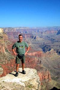
- Età 20930 giorni (57)
- Nulla arricchisce l'animo più dei ricordi ...
Nulla, oltre alle persone care, arricchisce i ricordi più di un viaggio ...
Forse nulla oltre ai ricordi porteremo con noi per l'eternità ...
Contacts
 my travel map my travel map
 rss fedd of my travel rss fedd of my travel
|